Near Manassas in Prince William County, Virginia — The American South (Mid-Atlantic)
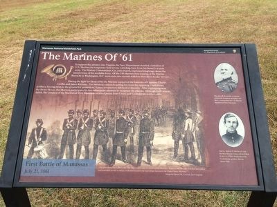
The Marines of '61
During the fight for Henry Hill, the Marines supported the batteries of Captains Charles Griffin and James Ricketts. The battalion endured a galling fire from the opposing Confederate artillery, forcing them to the ground for protection. Union troops soon fell back in disorder. After regrouping near the Stone House, the Marines participated in two subsequent attempts to recapture the plateau. Although both attacks failed, the conduct of the Marines at First Manassas received praise from Union and Confederate soldiers alike.
"The green pines were filled with 79th Highlanders and the red-breeched Brookly Zouaves, but the only men that were killed and wounded twenty to thrity yards behind and in the rear of our lines were the United States Marines."
-Surgeon Daniel M. Conrad, 2nd Virginia
(Captions):
Maj. John B. Reynolds, a veteran of both the Seminole and Mexican Wars, commanded the U.S. Marine Battalion at First Manassas.
2nd Lt. Robert E. Hitchcock was the first Marine Corps officer killed in the Civil War, struck down by Confederate artillery fire on Henry Hill.
Erected 2011 by National Park Service, Department of the Interior.
Topics. This historical marker is listed in this topic list: War, US Civil.
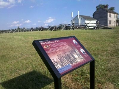
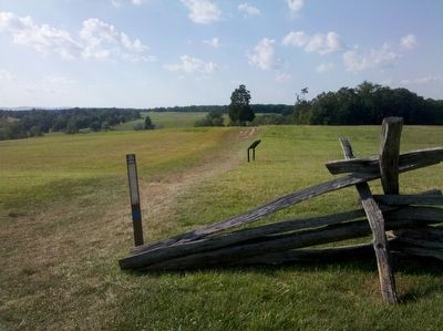
Location. 38° 48.918′ N, 77° 31.375′ W. Marker is near Manassas, Virginia, in Prince William County. Marker can be reached from Sudley Road (State Highway 234) 0.4 miles south of Lee Highway (U.S. 29), on the right when traveling north. The marker on the Henry House Hill trail, which starts at the Manassas National Battlefield Park visitor center. Touch for map. Marker is in this post office area: Manassas VA 20109, United States of America. Touch for directions.
Other nearby markers. At least 8 other markers are within walking distance of this marker. Colonel Cameron (within shouting distance of this marker); Judith Henry (within shouting distance of this marker); Invaded Farmland (within shouting distance of this marker); Honoring the Dead (within shouting distance of this marker); 1st Battle of Bull Run Memorial (within shouting distance of this marker); Wade Hampton (within shouting distance of this marker); Lieutenant Ramsey
(about 400 feet away, measured in a direct line); Flight from Matthews Hill (about 400 feet away). Touch for a list and map of all markers in Manassas.
Regarding The Marines of '61. Harris reported to Navy Secretary Nathan Gideon Welles after the fighting that this was "the first instance in Marine history where any portion of its members turned their backs to the enemy."
Also see . . . Video - - Dedication of Marker ::. (Submitted on August 15, 2011.)
Credits. This page was last revised on March 28, 2022. It was originally submitted on July 17, 2011, by Stephen Santelli of Morgantown, West Virginia. This page has been viewed 1,025 times since then and 32 times this year. Last updated on March 27, 2022, by Connor Olson of Kewaskum, Wisconsin. Photos: 1. submitted on September 28, 2015, by Shane Oliver of Richmond, Virginia. 2, 3. submitted on July 17, 2011, by Stephen Santelli of Morgantown, West Virginia. • J. Makali Bruton was the editor who published this page.


