Fort Sill in Comanche County, Oklahoma — The American South (West South Central)
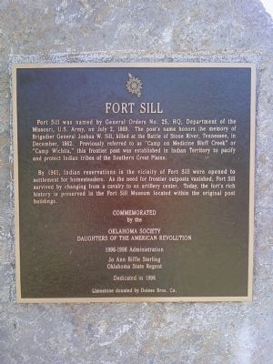
Fort Sill
By 1901, Indian reservations in the vicinity of Fort Sill were opened to settlement for homesteaders. As the need for frontier outposts vanished, Fort Sill survived by changing from a cavalry to an artillery center. Today, the fort's rich history is preserved in the Fort Sill Museum located within the original post buildings.
Commemorated by the Oklahoma Society Daughters of the American Revolution
1996-1998 Administration
Jo Ann Biffle Sterling
Oklahoma State Regent
Dedicated in 1998
Limestone donated by Dolese Bros. Co.
Erected 1998 by Oklahoma Society Daughters of the American Revolution.
Topics and series. This historical marker is listed in these topic lists: Forts and Castles • Native Americans • Settlements & Settlers • Wars, US Indian. In addition, it is included in the Daughters of the American Revolution series list. A significant historical month for this entry is July 1836.
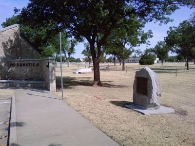
Location. 34° 39.715′ N, 98° 23.069′ W. Marker is in Fort Sill, Oklahoma, in Comanche County. Marker is on Sheridan Road west of H.E. Bailey Turnpike (Interstate 44), on the right when traveling west. Marker is located just inside Fort Sill's Key Gate, on the right near an old visitor's center. Access to Fort Sill requires appropriate identification for access. Touch for map. Marker is in this post office area: Fort Sill OK 73503, United States of America. Touch for directions.
Other nearby markers. At least 8 other markers are within walking distance of this marker. Soviet M1939 52-K 85mm Anti Aircraft Gun (approx. 0.2 miles away); M51 Skysweeper 75mm Anti Aircraft Gun (approx. 0.2 miles away); Lockheed X-7A1 Target Drone (approx. 0.2 miles away); MIM-3 Nike Ajax (approx. 0.2 miles away); Iraqi SZ-60 57mm Anti Aircraft Gun (approx. 0.2 miles away); MIM-14 Nike Hercules (approx. 0.2 miles away); Nike Hercules HIPAR Radar AN/FPS-71 Antenna (approx. 0.2 miles away); Sprint Missile (approx. 0.2 miles away). Touch for a list and map of all markers in Fort Sill.
Credits. This page was last revised on June 16, 2016. It was originally submitted on July 18, 2011, by Lee Hattabaugh of Capshaw, Alabama. This page has been viewed 1,053 times since then and 31 times this year. Photos: 1, 2. submitted on July 18, 2011, by Lee Hattabaugh of Capshaw, Alabama. • Bill Pfingsten was the editor who published this page.

