Riegelsville in Bucks County, Pennsylvania — The American Northeast (Mid-Atlantic)
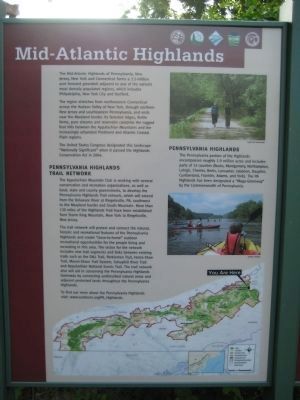
Mid-Atlantic Highlands
The region stretches from northwestern Connecticut across the Hudson Valley of New York, through northern New Jersey and southeastern Pennsylvania, and ends near the Maryland border. Its forested ridges, fertile farms, pure streams and reservoirs comprise the rugged foothills between the Appalachian Mountains and the increasingly urbanized Piedmont and Atlantic Coastal Plains regions.
The United States Congress designated this landscape "Nationally Significant" when it passed the Highlands Conservation Act in 2004.
Pennsylvania Highlands Trail Network
The Appalachian Mountain Club is working with several conservation and recreation organizations, as well as local, state and county governments, to develop the Pennsylvania Highlands Trail network, which will extend from the Delaware River at Riegelsville, PA, southwest to the Maryland border and South Mountain. More than 130 miles of Highlands Trail have been established from Storm King Mountain, New York to Riegelsville, New Jersey.
The trail network will protect and connect the natural, historic and recreational features of the Pennsylvania Highlands and create "close-to-home" outdoor recreational opportunities for people living and recreating in this area. The vision for the network includes new trail segments and links between existing trails such as the D&L Trail, Perkiomen Trail, Horse-Shoe Trail, Mason-Dixon-Trail System, Schuylkill River Trail and Appalachian National Scenic Trail. The trail network will also aid in conserving the Pennsylvania Highlands Greenway by connecting undisturbed natural ares and adjacent protected lands throughout the Pennsylvania Highlands.
Pennsylvania Highlands
The Pennsylvania portion of the Highlands encompasses roughly 1.9 million acres and includes parts of 13 counties (Bucks, Montgomery, Northampton, Lehigh, Chester, Berks, Lancaster, Lebanon, Dauphin, Cumberland, Franklin, Adams, and York). The PA Highlands has been designated a "Mega-Greenway" by the Commonwealth of Pennsylvania,
Topics. This historical marker is listed in this topic list: Natural Features. A significant historical year for this entry is 2004.
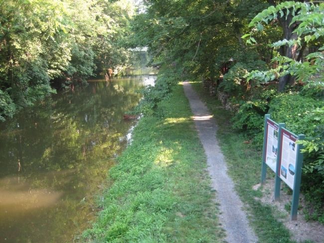
Location. 40° 35.628′ N, 75° 11.551′ W. Marker is in Riegelsville, Pennsylvania, in Bucks County. Marker can be reached from Delaware Road. The marker is located along the Delaware Canal Towpath close to the Riegelsville Bridge. Touch for map. Marker is in this post office area: Riegelsville PA 18077, United States of America. Touch for directions.
Other nearby markers. At
least 8 other markers are within one mile of this marker, measured as the crow flies. Riegelsville (here, next to this marker); Riegelsville Roebling Bridge (within shouting distance of this marker); Riegelsville Civil War Memorial (approx. ¼ mile away); The Riegelsville Academy and Public Library (approx. ¼ mile away); Riegelsville Historic District (approx. 0.3 miles away in New Jersey); Mt. Joy (approx. 0.4 miles away in New Jersey); Hunts Meadow (approx. ¾ mile away in New Jersey); Delaware Canal (approx. one mile away). Touch for a list and map of all markers in Riegelsville.
Credits. This page was last revised on August 19, 2023. It was originally submitted on July 19, 2011, by Alan Edelson of Union Twsp., New Jersey. This page has been viewed 632 times since then and 19 times this year. Last updated on August 17, 2023, by Carl Gordon Moore Jr. of North East, Maryland. Photos: 1, 2. submitted on July 19, 2011, by Alan Edelson of Union Twsp., New Jersey. • Bill Pfingsten was the editor who published this page.

