Hartford in Van Buren County, Michigan — The American Midwest (Great Lakes)
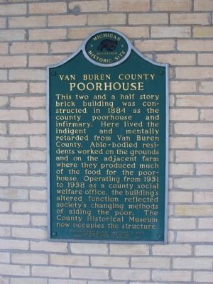
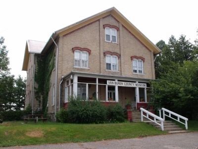
Van Buren County Poorhouse
Erected 1977 by Michigan History Division. (Marker Number 430.)
Topics and series. This historical marker is listed in this topic list: Charity & Public Work. In addition, it is included in the Michigan Historical Commission series list. A significant historical year for this entry is 1884.
Location. 42° 12.854′ N, 86° 7.02′ W. Marker is in Hartford, Michigan, in Van Buren County. Marker can be reached from Red Arrow Highway, 0.2 miles CR 681, on the right when traveling east. Located on North side of Van Buren County Fairgrounds and just West of the intersection of Red Arrow Highway and CR 681. Entrance is from Red Arrow Highway. Touch for map. Marker is at or near this postal address: 6215 Red Arrow Highway, Hartford MI 49057, United States of America. Touch for directions.
Other nearby markers. At least 8 other markers are within 11 miles of this marker , measured as the crow flies. Grand Army of the Republic (approx. 6.8 miles away); Hamilton Grange Hall / Hamilton Fair (approx. 7.7 miles away); Covert Library (approx. 9.3 miles away); Covert World War II Memorial (approx. 9.3 miles away); Coloma Interurban Station (approx. 9.8 miles away); Baker Park (approx. 9.9 miles away); Lakeside Cemetery Veterans Memorial (approx. 9.9 miles away); Decatur Township Hall (approx. 10.3 miles away).
More about this marker. Marker is on the outside wall of the building on an open front porch.
Credits. This page was last revised on June 16, 2016. It was originally submitted on July 20, 2011, by Dennis Allen Burlingham of Hartford, Michigan, USA. This page has been viewed 1,377 times since then and 56 times this year. Photos: 1, 2. submitted on July 20, 2011, by Dennis Allen Burlingham of Hartford, Michigan, USA. • Bill Pfingsten was the editor who published this page.

