Marker Logo HMdb.org THE HISTORICAL
MARKER DATABASE
“Bite-Size Bits of Local, National, and Global History”
Lookout Valley in Tiftonia in Hamilton County, Tennessee — The American South (East South Central)
 

Brown's Ferry


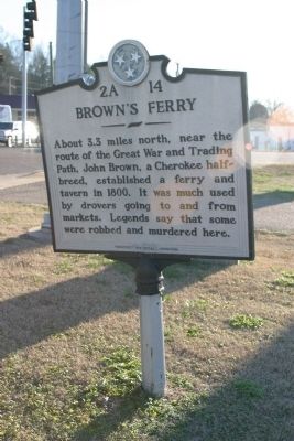
Brown's Ferry Marker image. Click for full size.
Photographed By R. E. Smith, January 3, 2008
1. Brown's Ferry Marker
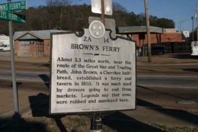
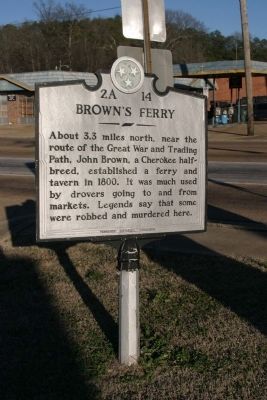
Inscription. About 3.3 miles north, near the route of the Great War and Trading Path, John Brown, a Cherokee half-breed, established a ferry and tavern in 1800. It was much used by drovers going to and from markets. Legends say that some were robbed and murdered here.
 
Erected by Tennessee Historical Commission. (Marker Number 2A 14.)
 
Topics and series. This historical marker is listed in these topic lists: LandmarksRoads & Vehicles. In addition, it is included in the Tennessee Historical Commission series list. A significant historical year for this entry is 1800.
 
Location. 35° 1.231′ N, 85° 21.95′ W. Marker is in Tiftonia, Tennessee, in Hamilton County. It is in Lookout Valley. Marker is at the intersection of Browns Ferry Road and Cummings Highway (U.S. 11), on the right when traveling south on Browns Ferry Road. Touch for map. Marker is in this post office area: Chattanooga TN 37419, United States of America. Touch for directions.
 
Other nearby markers. At least 8 other markers are within 2 miles of this marker, measured as the crow flies. Battle of Wauhatchie (within shouting distance of this marker); Wauhatchie (approx. half a mile away); New York Troops - 11th Corps (approx. 0.6 miles away); Battle of Lookout Mountain (approx. 0.6 miles away); Lookout Creek (approx. 0.6 miles away); Wiedrich's New York Battery
Paid Advertisement
Click on the ad for more information.
Please report objectionable advertising to the Editor.
Click or scan to see
this page online
(approx. 0.8 miles away); Greene's New York Brigade (approx. 0.9 miles away); Heavy Slashings of Timber (approx. 1.2 miles away). Touch for a list and map of all markers in Tiftonia.
 
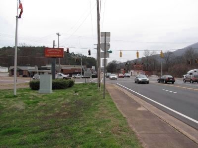
Brown's Ferry Marker image. Click for full size.
Photographed By R. E. Smith, January 3, 2008
2. Brown's Ferry Marker
Brown's Ferry Marker image. Click for full size.
Photographed By R. E. Smith, January 3, 2008
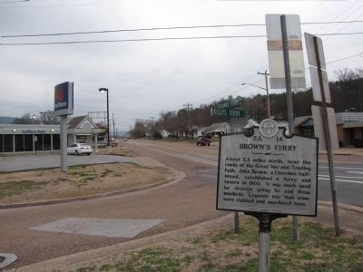
3. Brown's Ferry Marker
Brown's Ferry Marker image. Click for full size.
Photographed By Lee Hattabaugh, March 17, 2010
4. Brown's Ferry Marker
Intersection of Browns Ferry Rd and Cummings Hwy looking East along Cummings Hwy. Marker is on the left beneath the fire department sign.
Brown's Ferry Marker image. Click for full size.
Photographed By Lee Hattabaugh, March 17, 2010
5. Brown's Ferry Marker
Photo of the marker looking North along Browns Ferry Rd.
Brown's Ferry Marker image. Click for full size.
Photographed By Dale K. Benington, July 9, 2010
6. Brown's Ferry Marker
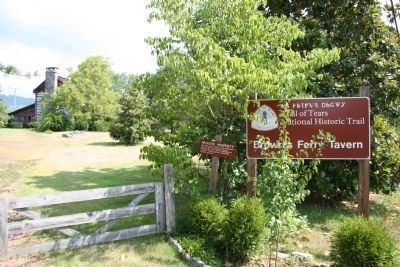
View looking north along Brown's Ferry Road, with a view of the National Park Service's sign for the Brown Ferry Tavern on the left side of the picture.
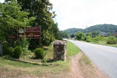
Brown's Ferry Marker image. Click for full size.
Photographed By Dale K. Benington, July 9, 2010
7. Brown's Ferry Marker
View of the entrance to National Park Services facility at the Brown's Ferry Tavern, which is discussed in the featured historical marker.
 
 
Credits. This page was last revised on February 7, 2023. It was originally submitted on January 3, 2008, by R. E. Smith of Nashville, Tennessee. This page has been viewed 3,023 times since then and 71 times this year. Photos:   1, 2, 3. submitted on January 3, 2008, by R. E. Smith of Nashville, Tennessee.   4, 5. submitted on March 18, 2010, by Lee Hattabaugh of Capshaw, Alabama.   6, 7. submitted on December 29, 2010, by Dale K. Benington of Toledo, Ohio. • Kevin W. was the editor who published this page.
Share this page.  
Share on Tumblr
m=4485

CeraNet Cloud Computing sponsors the Historical Marker Database.
This website earns income from purchases you make after using our links to Amazon.com. We appreciate your support.
Paid Advertisement
Apr. 25, 2024