Lebanon in Laclede County, Missouri — The American Midwest (Upper Plains)
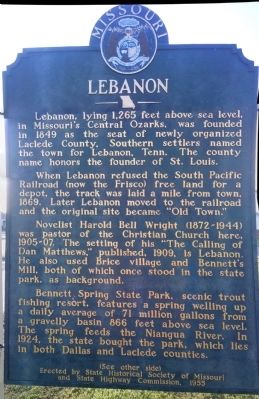
Lebanon
When Lebanon refused the South Pacific Railroad (now the Frisco) free land for a depot, the track was laid a mile from town, 1869. Later Lebanon moved to the railroad and the original site became "Old Town."
Novelist Harold Bell Wright (1872-1944) was pastor of the Christian Church here, 1905-07. The setting of his "The Calling of Dan Matthews," published, 1909, is Lebanon. He also used Brice village and Bennett's Mill, both of which once stood in the state park, as background.
Bennett Spring State Park, scenic trout fishing resort, features a spring welling up a daily average of 71 million gallons from a gravelly basin 866 feet above sea level. The spring feeds the Niangua River. In 1924, the state bought the park, which lies in both Dallas and Laclede counties.
(See other side)
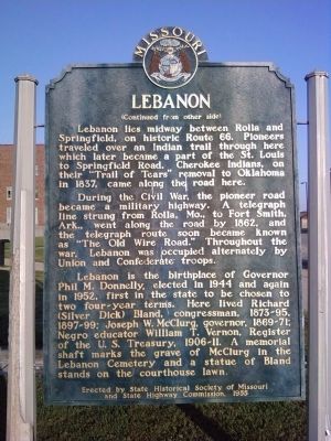
(Continued from other side)
Lebanon lies midway between Rolla and Springfield, on historic Route 66. Pioneers traveled over an Indian trail through here which later became a part of the St. Louis to Springfield Road. Cherokee Indians, on their "Trail of Tears" removal to Oklahoma in 1837, came along the road here.
During the Civil War, the pioneer road became a military highway. A telegraph line strung from Rolla, Mo., to Fort Smith, Ark., went along the road by 1862, and the telegraph route soon became known as "The Old Wire Road." Throughout the war, Lebanon was occupied alternately by Union and Confederate troops.
Lebanon is the birthplace of Governor Phil M. Donnelly, elected in 1944 and again in 1952, first in the state to be chosen to two four-year terms. Here lived Richard (Silver Dick) Bland, congressman, 1873-95, 1897-99; Joseph W. McClurg, governor, 1869-71; Negro educator William T. Vernon, Register of the U.S. Treasury, 1906-11. A memorial shaft marks the grave of McClurg in the Lebanon Cemetery and a statue of Bland stands on the courthouse lawn.
Erected 1955 by State Historical Society of Missouri and State Highway Commission.
Topics and series. This historical marker is listed in these topic lists: Government & Politics • Native Americans • Railroads & Streetcars • Settlements & Settlers. In addition, it is included in the Missouri, The State Historical Society of, and the Trail of Tears series lists. A significant historical year for this entry is 1849.
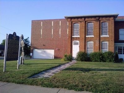
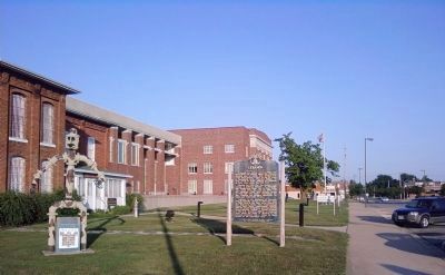
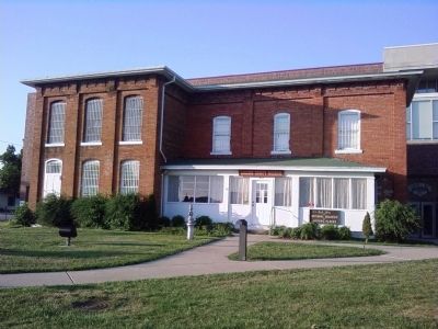
Location. 37° 40.983′ N, 92° 39.883′ W. Marker is in Lebanon, Missouri, in Laclede County. Marker is at the intersection of Adams Avenue and 3rd Street, on the right when traveling north on Adams Avenue. Located in front of the Laclede County Courthouse and the Historical Society. The Historical Society is housed in the Old Jail, which is on the National Register of Historic Places. Touch for map. Marker is in this post office area: Lebanon MO 65536, United States of America. Touch for directions.
Other nearby markers. At least 7 other markers are within walking distance of this marker. "Stormin' Norman Pipeline" (a few steps from this marker); Richard Parks Bland (about 300 feet away, measured in a direct line); Veterans Memorial (approx. 0.6 miles away); War Memorial (approx. 0.6 miles away); Nelson Family Legacy (approx. 0.9 miles away); Laclede County (approx. 0.9 miles away); Camp Joy (approx. one mile away).
Credits. This page was last revised on June 16, 2016. It was originally submitted on July 22, 2011, by Lee Hattabaugh of Capshaw, Alabama. This page has been viewed 1,219 times since then and 28 times this year. Photos: 1, 2, 3, 4, 5. submitted on July 22, 2011, by Lee Hattabaugh of Capshaw, Alabama. • Bill Pfingsten was the editor who published this page.
