Wytheville in Wythe County, Virginia — The American South (Mid-Atlantic)
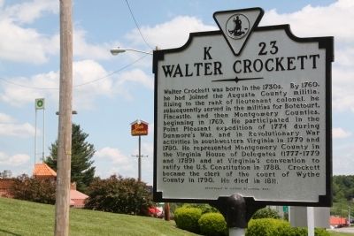
Walter Crockett
Erected 2001 by Department of Historic Resources. (Marker Number K-23.)
Topics and series. This historical marker is listed in these topic lists: Colonial Era • War, US Revolutionary • Waterways & Vessels. In addition, it is included in the Virginia Department of Historic Resources (DHR) series list. A significant historical year for this entry is 1760.
Location. 36° 56.866′ N, 81° 3.551′ W. Marker is in Wytheville, Virginia, in Wythe County. Marker is at the intersection of East Main Street (U.S. 11) and Exit 73 (Interstate 81), on the right when traveling west on East Main Street. It is on the south side of I-81 on the road into town. Touch for map. Marker is in this post office area: Wytheville VA 24382, United States of America. Touch for directions.
Other nearby markers. At least 8 other markers are within 2 miles of this marker, measured as the crow flies. Robert Enoch Withers (approx. 0.6 miles away); Our Confederate Dead (approx. 1.1 miles away); Wytheville Training School (approx. 1.1 miles away); St. John's Episcopal Church (approx. 1.3 miles away); Edith Bolling Wilson (approx. 1.3 miles away); Wytheville (approx. 1.3 miles away); Boone Trail Highway Memorial (approx. 1.3 miles away); Home Site of Christopher (Stophel) Simmerman (approx. 1.4 miles away). Touch for a list and map of all markers in Wytheville.
More about this marker. This marker replaced a 1930s marker with the same number titled “A Colonial Soldier’s Home” that read, “Five miles north was the home of Walter Crockett, a captain in the Point Pleasant Indian expedition of 1774 and the suppressor of a Tory rising in 1779. He was county lieutenant and clerk of Wythe County.”
Regarding Walter Crockett. He was born in present-day Tazewell County.
Also see . . . Lord Dunmore's War and the Battle of Point Pleasant. “In August 1774, Pennsylvania militia entered the Ohio Country and quickly destroyed seven Mingo villages, which the Indians had abandoned as the soldiers approached. At the same time, Lord Dunmore sent one thousand men to the Kanawha River in modern-day West Virginia to build a fort and to attack the Shawnees. Cornstalk, who had experienced a change of heart toward the white colonists as the soldiers invaded the Ohio Country, sent nearly one thousand warriors to drive Dunmore’s force from the region. The forces met on October 10, 1774, at what became known as the Battle of Point Pleasant. After several hours of intense fighting, the English drove Cornstalk’s followers north of the Ohio River.” (Submitted on July 23, 2011.)
Credits. This page was last revised on December 27, 2019. It was originally submitted on July 23, 2011, by J. J. Prats of Powell, Ohio. This page has been viewed 1,586 times since then and 72 times this year. Photos: 1, 2. submitted on July 23, 2011, by J. J. Prats of Powell, Ohio.

