Wytheville in Wythe County, Virginia — The American South (Mid-Atlantic)
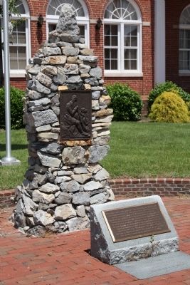
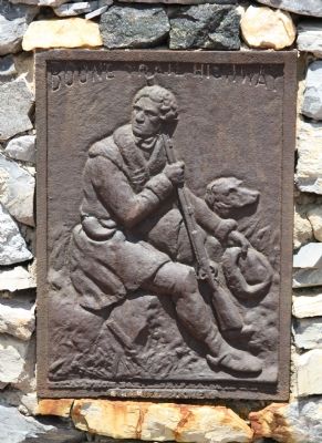
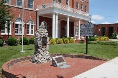
Boone Trail Highway Memorial
Inscription.
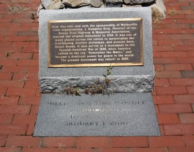
Near his site, and with the sponsorship of Wytheville
civic organizations, J. Hampton Rich, Director of the
Boone 'Fran Highway & Memorial Association,
erected the original monument in 1928. It was one of
many placed across the nation to memorialize the
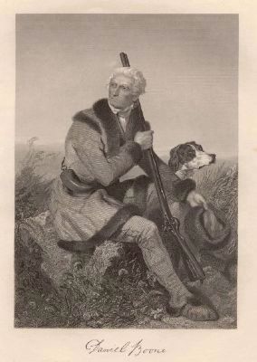
trail-blazing, frontier statesman, and pioneer hero,
Daniel Boone. It also serves as a monument to the
Spanish-American War of 1898, when. America
rallied to the cry, “Remember the Maine,” and
became a dominant power for peace in the world.
The present monument was rebuilt in 2005.
Erected 2005.
Topics. This historical marker and memorial is listed in these topic lists: Roads & Vehicles • Settlements & Settlers. A significant historical year for this entry is 1928.
Location. 36° 57.019′ N, 81° 4.988′ W. Marker is in Wytheville, Virginia, in Wythe County. Marker is on East Main Street (U.S. 11) just west of 1st Street, on the right when traveling west. It is at the former George Wythe Hotel. Touch for map. Marker is in this post office area: Wytheville VA 24382, United States of America. Touch for directions.
Other nearby markers. At least 8 other markers are within walking distance of this marker. Wytheville (here, next to this marker); Edith Bolling Wilson (within shouting distance of this marker); The Haller-Gibboney Rock House (about 400 feet away, measured in a direct line); St. John's Episcopal Church (about 400 feet away); Home Site of Christopher (Stophel) Simmerman (about 400 feet away); Welcome to the Thomas J. Boyd Museum (about 600 feet away); The Lynching of Raymond Byrd (about 800 feet away); LOVE (about 800 feet away). Touch for a list and map of all markers in Wytheville.
Also see . . .
1. Boone Trail Highway. Wikipedia entry. “Between 1913 and 1938, J.(Joseph) Hampton Rich, a resident of Mocksville, North Carolina, USA took it upon himself to keep the memory of Daniel Boone and his travels alive. He did this by placing 358 metal tablets between Virginia Beach, VA and San Francisco, CA. Although many of the tablets are associated with locations visited by Boone, many were simply placed wherever Mr. Rich could collect the necessary donations from schools, communities, etc. to erect a monument. He established the Boone Trail Highway Association to further his project. From the mid-1920s to the mid-1930s, the Association published a newsletter which detailed the efforts to install new monuments.
“Interestingly enough, the markers also have a link to more recent history. Supposedly, the tablets were (at least partially) constructed from metal salvaged from the battleship USS Maine, which was sunk during Spanish-American War in 1898. Typically, the tablets were located near schools, government buildings or along old highway routes. Over the years many of the markers have been lost to highway construction and general urban sprawl.” (Submitted on July 23, 2011.)
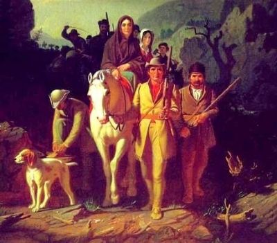
2. Daniel Boone. Wikipedia entry. “Daniel Boone ... was an American pioneer, explorer, and frontiersman whose frontier exploits made him one of the first folk heroes of the United States. Boone is most famous for his exploration and settlement of what is now the Commonwealth of Kentucky, which was then beyond the western borders of the settled part of the Thirteen Colonies. This region legally belonged to both the Commonwealth of Virginia and to the American Indian Tribes at the time. Despite some resistance from American Indian tribes such as the Shawnee, in 1775 Boone blazed his Wilderness Road through the Cumberland Gap in the Appalachian Mountains from North Carolina and Tennessee into Kentucky. ... Boone was a militia officer during the Revolutionary War (1775–82), which in Kentucky was fought primarily between the European settlers and the British-aided Native Americans. Boone was captured by Shawnee warriors in 1778, who after a while adopted him into their tribe. Later, he left the Indians and returned to Boonesborough in order to help defend the European settlements in Kentucky/Virginia. Boone was elected to the first of his three terms in the Virginia General Assembly during the Revolutionary War, and fought in the Battle of Blue Licks in 1782, which was one of the final battles of the American Revolution.” (Submitted on July 24, 2011.)
Credits. This page was last revised on June 16, 2016. It was originally submitted on July 23, 2011, by J. J. Prats of Powell, Ohio. This page has been viewed 1,122 times since then and 43 times this year. Photos: 1, 2, 3. submitted on July 23, 2011, by J. J. Prats of Powell, Ohio. 4. submitted on July 24, 2011, by J. J. Prats of Powell, Ohio. 5, 6. submitted on July 23, 2011, by J. J. Prats of Powell, Ohio.
Editor’s want-list for this marker. Photos of other metal tablets still standing • Can you help?
