Near Rural Retreat in Wythe County, Virginia — The American South (Mid-Atlantic)
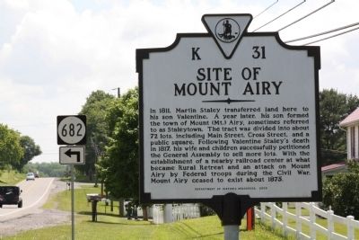
Site of Mount Airy
Erected 2005 by Department of Historic Resources. (Marker Number K-31.)
Topics and series. This historical marker is listed in these topic lists: Settlements & Settlers • War, US Civil. In addition, it is included in the Virginia Department of Historic Resources (DHR) series list. A significant historical year for this entry is 1811.
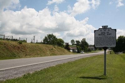
Location. 36° 54.193′ N, 81° 18.632′ W. Marker is near Rural Retreat, Virginia, in Wythe County. Marker is on West Lee Highway (U.S. 11) just west of Kimberling Road (County Route 682). U.S. 11 parallels I-81 between exits 64 and 60. Touch for map. Marker is in this post office area: Rural Retreat VA 24368, United States of America. Touch for directions.
Other nearby markers. At least 8 other markers are within 11 miles of this marker, measured as the crow flies. Early Settlers (approx. 3.6 miles away); Henry C. Groseclose (approx. 8.1 miles away); Battle of Wytheville (approx. 8.4 miles away); a different marker also named Battle of Wytheville (approx. 9.9 miles away); Battle of Marion (approx. 10.6 miles away); State Fish Hatchery (approx. 10.8 miles away); Sherwood Anderson (approx. 10.8 miles away); a different marker also named Battle of Wytheville (approx. 10.9 miles away).
Credits. This page was last revised on September 28, 2020. It was originally submitted on July 24, 2011, by J. J. Prats of Powell, Ohio. This page has been viewed 1,019 times since then and 70 times this year. Photos: 1, 2. submitted on July 24, 2011, by J. J. Prats of Powell, Ohio.

