Council Grove in Morris County, Kansas — The American Midwest (Upper Plains)
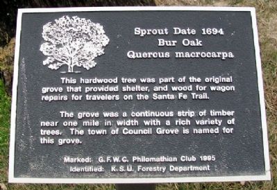
Bur Oak
Quercus macrocarpa
— Sprout Date 1694 —
This hardwood tree was part of the original grove that provided shelter, and wood for wagon repairs for travelers on the Santa Fe Trail.
The grove was a continuous strip of timber near one mile in width with a rich variety of trees. The town of Council Grove is named for this grove.
[Tree] Identified [by] K.S.U. Forestry Department
Erected 1995 by G. F. W. C. Philomathian Club.
Topics and series. This historical marker is listed in these topic lists: Environment • Industry & Commerce • Roads & Vehicles • Settlements & Settlers. In addition, it is included in the Historic Trees, and the Santa Fe Trail series lists.
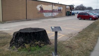
Location. 38° 39.691′ N, 96° 29.097′ W. Marker is in Council Grove, Kansas, in Morris County. Marker is at the intersection of Main Street (U.S. 56) and 2nd Street, on the right when traveling east on Main Street. Marker is adjacent to the east end of Ray's Apple Market parking lot. Touch for map. Marker is at or near this postal address: 115 East Main Street, Council Grove KS 66846, United States of America. Touch for directions.
Other nearby markers. At least 8 other markers are within walking distance of this marker. A different marker also named Bur Oak (within shouting distance of this marker); Council Oak (within shouting distance of this marker); Santa Fe Trail / Council Grove (within shouting distance of this marker); a different marker also named Council Oak (within shouting distance of this marker); Council Grove (within shouting distance of this marker); Company "C" 137th Infantry (about 300 feet away, measured in a direct line); Post Office Oak (about 400 feet away); Brewery (about 400 feet away). Touch for a list and map of all markers in Council Grove.
Also see . . .
1. Quercus macrocarpa (bur oak). Wikipedia entry (Submitted on August 23, 2023, by Larry Gertner of New York, New York.)
2. Our Rich History. Council Grove Area Trade & Tourism Association. (Submitted on July 24, 2011, by William Fischer, Jr. of Scranton, Pennsylvania.)
3. Santa Fe National Historic Trail. National Park Service website entry (Submitted on July 24, 2011, by William Fischer, Jr. of Scranton, Pennsylvania.)
4. Santa Fe Trail Association. Website homepage (Submitted on July 24, 2011, by William Fischer, Jr. of Scranton, Pennsylvania.)
Credits. This page was last revised on August 23, 2023. It was originally submitted on July 24, 2011, by William Fischer, Jr. of Scranton, Pennsylvania. This page has been viewed 475 times since then and 13 times this year. Photos: 1, 2. submitted on July 24, 2011, by William Fischer, Jr. of Scranton, Pennsylvania.

