Near Council Grove in Morris County, Kansas — The American Midwest (Upper Plains)
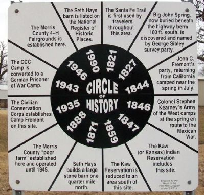
Morris County 4-H Fairgrounds Circle of History
Inscription.
1821 The Santa Fe Trail is first used by travelers throughout this area.
1827 Big John Spring, now buried beneath the highway berm 100 ft. south, is discovered and named by George Sibley survey party.
1844 John C. Fremont's party, returning from California, camped near the spring in July.
1846 Colonel Stephen Kearney's Army of the West camps at the spring en route to the Mexican War.
1847 The Kaw (or Kansas) Indian Reservation includes this site.
1859 The Kaw Reservation is reduced to an area south of this site.
1871 Seth Hays builds a large stone barn one quarter mile north.
1888 The Morris County "poor farm" established here and operated until 1945.
1935 The Civilian Conservation Corps establishes Camp Fremont on this site.
1943 The CCC Camp is converted to a German Prisoner of War Camp.
1946 The Morris County 4-H Fairgrounds is established here.
1990 The Seth Hays barn is listed on the National Register of Historic Places.
Erected by Heart of the Flint Hills Chapter, Santa Fe Trail Association.
Topics and series. This historical marker is listed in these topic lists: Fraternal or Sororal Organizations • Native Americans • Roads & Vehicles • Settlements & Settlers. In addition, it is included in the 4-H Youth Program, and the Civilian Conservation Corps (CCC) series lists. A significant historical year for this entry is 1821.
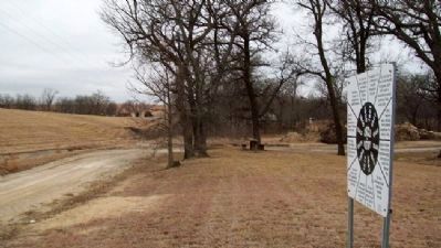
Location. 38° 40.021′ N, 96° 26.934′ W. Marker is near Council Grove, Kansas, in Morris County. Marker is on U.S. 56, on the left when traveling east. Marker is at the Morris County Fairgrounds. Touch for map. Marker is in this post office area: Council Grove KS 66846, United States of America. Touch for directions.
Other nearby markers. At least 8 other markers are within 2 miles of this marker, measured as the crow flies. The Limestone Bank Barn (approx. 0.2 miles away); Sylvan Park Depot (approx. 1.7 miles away); Pioneer Cowboy Jail (approx. 1.8 miles away); Company "C" 137th Infantry (approx. 1.9 miles away); Council Grove (approx. 1.9 miles away); Council Oak (approx. 1.9 miles away); Santa Fe Trail / Council Grove (approx. 1.9 miles away); a different marker also named Council Oak (approx. 1.9 miles away). Touch for a list and map of all markers in Council Grove.
Also see . . .
1. Morris County, Kansas. Kansas Historical Society website entry (Submitted on July 25, 2011, by William Fischer, Jr. of Scranton, Pennsylvania.)
2. Our Rich History. Council Grove Area Trade & Tourism Association website entry (Submitted on July 25, 2011, by William Fischer, Jr. of Scranton, Pennsylvania.)
3. 8 Wonders of Kansas History: Council Grove, Santa Fe Trail National Historic Landmark. Kansas Sampler Foundation website entry (Submitted on July 25, 2011, by William Fischer, Jr. of Scranton, Pennsylvania.)
4. Santa Fe Trail Association. Assoication website entry (Submitted on July 25, 2011, by William Fischer, Jr. of Scranton, Pennsylvania.)
Credits. This page was last revised on August 29, 2023. It was originally submitted on July 25, 2011, by William Fischer, Jr. of Scranton, Pennsylvania. This page has been viewed 611 times since then and 21 times this year. Last updated on February 18, 2022, by Carl Gordon Moore Jr. of North East, Maryland. Photos: 1, 2. submitted on July 25, 2011, by William Fischer, Jr. of Scranton, Pennsylvania. • J. Makali Bruton was the editor who published this page.

