Truth or Consequences in Sierra County, New Mexico — The American Mountains (Southwest)
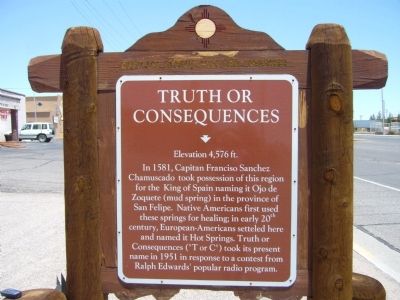
Truth or Consequences
Elevation 4,576 ft.
Erected by New Mexico Historic Preservation Division.
Topics and series. This historical marker is listed in these topic lists: Exploration • Settlements & Settlers. In addition, it is included in the El Camino Real de Tierra Adentro series list. A significant historical year for this entry is 1581.
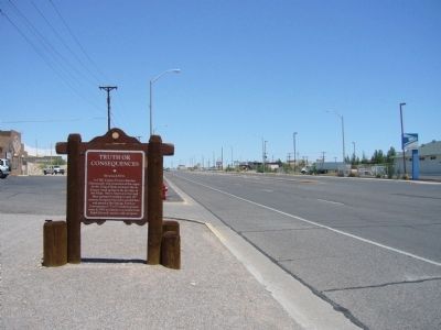
Location. 33° 8.696′ N, 107° 14.919′ W. Marker is in Truth or Consequences, New Mexico, in Sierra County. Marker is on North Date Street, on the left when traveling north. Touch for map. Marker is at or near this postal address: 1500 North Date Street, Truth or Consequences NM 87901, United States of America. Touch for directions.
Other nearby markers. At least 7 other markers are within 14 miles of this marker, measured as the crow flies. Elephant Butte Lake State Park (approx. 0.8 miles away); Magnolia Ellis, “Magnificent Magnolia” (approx. 1.1 miles away); a different marker also named Truth or Consequences (approx. 2.8 miles away); Elephant Butte Dam (approx. 3.4 miles away); Fort McRae 1863-1876 (approx. 3½ miles away); Jornada del Muerto (approx. 11.9 miles away); Caballo Mountains (approx. 13.8 miles away).
Regarding Truth or Consequences. "Francisco" is misspelled as "Franciso" in the marker text.
Credits. This page was last revised on March 7, 2024. It was originally submitted on July 27, 2011, by Bill Kirchner of Tucson, Arizona. This page has been viewed 682 times since then and 46 times this year. Last updated on March 6, 2024, by Carl Gordon Moore Jr. of North East, Maryland. Photos: 1, 2, 3. submitted on July 27, 2011, by Bill Kirchner of Tucson, Arizona. • J. Makali Bruton was the editor who published this page.


