Near Socorro in Socorro County, New Mexico — The American Mountains (Southwest)
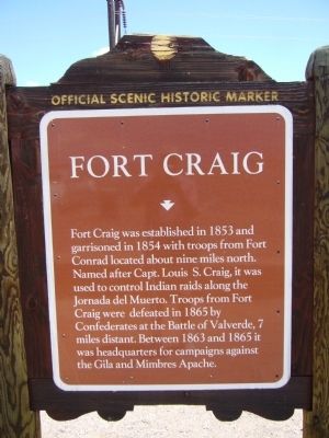
Fort Craig
Fort Craig was established in 1853 and garrisoned in 1854 with troops from Fort Conrad located about nine miles north. Named after Capt. Louis S. Craig, it was used to control Indian raids along the Jornada del Muerto. Troops from Fort Craig were defeated in 1865 by Confederates at the Battle of Valverde, 7 miles distant. Between 1863 and 1865 it was headquarters for campaigns against the Gila and Mimbres Apache.
Erected by New Mexico Historic Preservation Division.
Topics and series. This historical marker is listed in these topic lists: Forts and Castles • War, US Civil • Wars, US Indian. In addition, it is included in the El Camino Real de Tierra Adentro series list. A significant historical year for this entry is 1853.
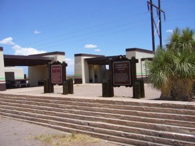
Location. 33° 37.266′ N, 107° 8.269′ W. Marker is near Socorro, New Mexico, in Socorro County. Marker is on Interstate 25 at milepost 114, on the right when traveling north. Marker is in the northbound rest area. Touch for map. Marker is in this post office area: Socorro NM 87801, United States of America. Touch for directions.
Other nearby markers. At least 8 other markers are within 11 miles of this marker, measured as the crow flies. Vásquez de Coronado’s Route (here, next to this marker); Women of the Camino Real (within shouting distance of this marker); Paraje De Fra Cristobal (within shouting distance of this marker); Espejo's Expedition (about 600 feet away, measured in a direct line); Paraje de Fra Cristobal (about 600 feet away); Fort Craig Rest Area (about 600 feet away); a different marker also named Fort Craig (approx. 7.2 miles away); In Memory of Texas Mounted Volunteers (approx. 10.6 miles away). Touch for a list and map of all markers in Socorro.
Also see . . . New Mexico: Fort Craig. National Park Service website entry (Submitted on December 8, 2022, by Larry Gertner of New York, New York.)
Credits. This page was last revised on December 8, 2022. It was originally submitted on July 27, 2011, by Bill Kirchner of Tucson, Arizona. This page has been viewed 758 times since then and 17 times this year. Photos: 1, 2, 3. submitted on July 27, 2011, by Bill Kirchner of Tucson, Arizona. • Craig Swain was the editor who published this page.


