Paradise in Sanders County, Montana — The American West (Mountains)
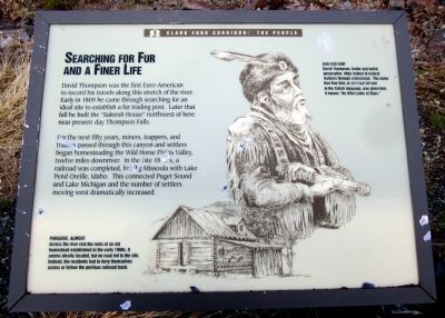
Searching For Fur And A Finer Life
Clark Fork Corridor: The People
For the next fifty years, miners, trappers, and traders passed through this canyon and settlers began homesteading the Wild Horse Plains Valley, twelve miles down river. In the late 1880’s a railroad was completed, linking Missoula with Lake Pend Oreille, Idaho. This connected the Puget Sound and Lake Michigan and the number of settlers moving west dramatically increased.
Paradise, Almost
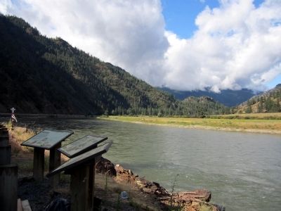
Across the river rest the ruins of an old homestead established in the early 1900s. It seems ideally located, but no road led to the site. Instead, the residents had to ferry themselves across or follow the perilous railroad track.
Koo Koo Sint
David Thompson, trader and noted geographer, often looked at natural features through a telescope. The name Koo Koo Sint, or sxw cl xlkw ukw usm in the Salish language, was given him. It means “He Who Looks at Stars.”
Erected by Lolo National Forest.
Topics. This historical marker is listed in these topic lists: Exploration • Settlements & Settlers. A significant historical year for this entry is 1809.
Location. 47° 20.294′ N, 114° 46.748′ W. Marker is in Paradise, Montana, in Sanders County. Marker is on State Highway 135, 1.2 miles south of State Highway 200, on the right when traveling south. Touch for map. Marker is in this post office area: Paradise MT 59856, United States of America. Touch for directions.
Other nearby markers. At least 8 other markers are within 12 miles of this marker, measured as the crow flies. Wildlife Thrive In Corridor Year Round (a few steps from this marker); Coursing Through Miles Of Montana (a few steps from this marker); Phantom Formation Is Rock Solid In Corridor (approx. 1.9 miles away); Native People Sustained Through Many Millennia (approx. 1.9 miles away); The Earth's Blood Flows Past You (approx. 1.9 miles away); Wild Horse Plains (approx. 9.4 miles away); Gideon Bibles (approx. 11 miles away); Superior School (approx. 11.2 miles away). Touch for a list and map of all markers in Paradise.
Also see . . . Lolo National Forest. (Submitted on July 29, 2011, by Bernard Fisher of Richmond, Virginia.)
Credits. This page was last revised on June 16, 2016. It was originally submitted on July 29, 2011, by Bernard Fisher of Richmond, Virginia. This page has been viewed 528 times since then and 8 times this year. Photos: 1, 2. submitted on July 29, 2011, by Bernard Fisher of Richmond, Virginia.

