East Portal in Mineral County, Montana — The American West (Mountains)
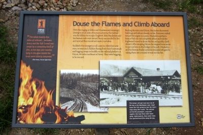
Douse the Flames and Climb Aboard
“The whole twenty-five miles of railroad…between Avery and the Taft Tunnel was swept by a consuming blast of fire, so hot that pick handles lying in the open beside the track were utterly consumed.” - Elers Koch, Forest Supervisor
With fires raging in Idaho and Montana and seemingly closing in on all sides of numerous towns, the railroad was the lifeline for escape. Engineer John Mackedon and his fireman rode west toward Avery surrounded by fire and worried they would not make it out alive.
Suddenly the emergency call came in. More fires sent men, women and children fleeing from their homesteads and logging camps to huddle on the railroad platform in Falcon, 64 miles northeast of Avery. They were begging to be rescued.
Backing the train into Falcon, Mackedon discovered buildings and railcars already on fire. Everyone rushed toward the engine in a panic. Mackedon spotted a boxcar that was not completely ablaze and told the frightened crowd to douse the fire and quickly climb aboard. After escaping Falcon, he stopped twice more to put out fires on the bridges in his path. Mackedon and his fireman finally saved the stranded refugees by taking them into a tunnel to wait out the fire.
Erected 2010 by Lolo National Forest.
Topics. This historical marker is listed in these topic lists: Disasters • Railroads & Streetcars.
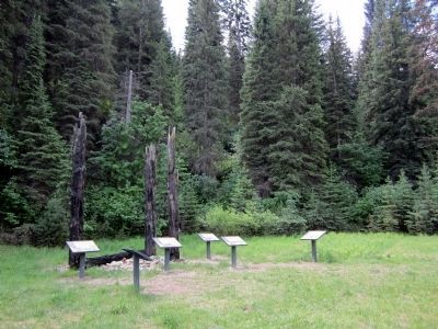
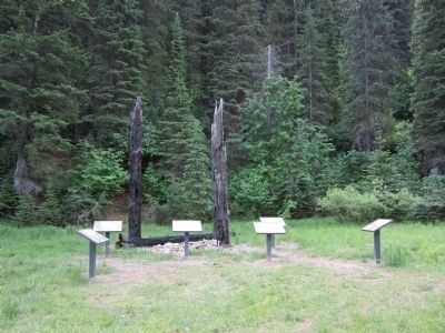
Location. 47° 23.776′ N, 115° 38.103′ W. Marker is in East Portal, Montana, in Mineral County. Marker can be reached from Rainy Creek Road (Federal Road 506) 2 miles south of Exit 5 (Taft) (Interstate 90). Located at the Route of the Hiawatha Trailhead. Touch for map. Marker is in this post office area: Saltese MT 59867, United States of America. Touch for directions.
Other nearby markers. At least 8 other markers are within walking distance of this marker. Building From the Ashes (a few steps from this marker); An Unlikely Safe Haven (a few steps from this marker); When the Mountains Roared (a few steps from this marker); A Battle That Could Not Be Won (within shouting distance of this marker); The Wickedest City (within shouting distance of this marker); The Route of the Hiawatha (within shouting distance of this marker); Pluck and Good Fortune (within shouting distance of this marker); The Trail Follows the Trains (within shouting distance of this marker). Touch for a list and map of all markers in East Portal.
More about this marker. On the bottom right are two photos with the caption, "This former railroad track once ran all the way to the Washington coast. Small towns like Taft sprang up near the train’s stops along their routes. The railroad carried passengers, cargo and supplies that kept these small towns going. Unfortunately, these same trains also sparked brush fires along the way."
photo: Forest Service Northern Region Archives
photo: Mineral County Museum
Also see . . . 1910 Fire Commemoration Information Site. US Forest Service (Submitted on August 3, 2011, by Bernard Fisher of Richmond, Virginia.)
Credits. This page was last revised on October 15, 2020. It was originally submitted on August 3, 2011, by Bernard Fisher of Richmond, Virginia. This page has been viewed 928 times since then and 16 times this year. It was the Marker of the Week April 27, 2014. Photos: 1, 2, 3. submitted on August 3, 2011, by Bernard Fisher of Richmond, Virginia.


