East Portal in Mineral County, Montana — The American West (Mountains)
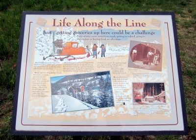
Life Along the Line
Just getting groceries up here could be a challenge
Deep winter snow sometimes made getting to school, going to the doctor, or buying food an adventure.
Families living at the top of the Bitterroot Mountains, here at East Portal and Roland, made the most out of a lonely situation.
When winter’s deep snow closed the roads, residents ran errands on borrowed “motor cars” that ran on rails, or hitched rides on passing trains. The trains would drop off mail-order groceries, medicines and household supplies.
Doris Walton lived both at East Portal and Roland with her husband Homer, the Section Foreman, and her children. She remembers being busy monitoring the weather station and keeping her children occupied. In summer, there was berry picking, fishing and exploring mountain trails.
Winter brought sledding, snow fights and school.
During the school term, kids boarded with relatives in Avery, or mom and kid stayed in a hotel in Wallace at school district expense. In the early 1950s, students rode to the school bus stop on at Taft on a large “Snow Cat” snowmobile.
Topics. This historical marker is listed in this topic list: Railroads & Streetcars.
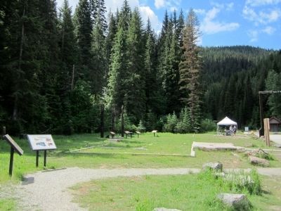
Location. 47° 23.797′ N, 115° 38.093′ W. Marker is in East Portal, Montana, in Mineral County. Marker can be reached from Rainy Creek Road (Federal Road 506) 2 miles south of Exit 5 (Taft) (Interstate 90). Located at the Route of the Hiawatha Trailhead. Touch for map. Marker is in this post office area: Saltese MT 59867, United States of America. Touch for directions.
Other nearby markers. At least 8 other markers are within walking distance of this marker. Substation 13 (here, next to this marker); Pluck and Good Fortune (a few steps from this marker); A Battle That Could Not Be Won (a few steps from this marker); When the Mountains Roared (a few steps from this marker); An Unlikely Safe Haven (within shouting distance of this marker); Building From the Ashes (within shouting distance of this marker); Douse the Flames and Climb Aboard (within shouting distance of this marker); The Route of the Hiawatha (within shouting distance of this marker). Touch for a list and map of all markers in East Portal.
More about this marker. On top left is an illustration with the caption, "One hardy East Portal family used a propeller-driven “Snow Go” to get down to and back from the highway at Taft, Montana."
On the lower left is a photo of the substation in snow. Jack Barger Photo, Ed Lynch collection
On top right is a photo with the caption, "A wary audience watches the struggles of a bear cub held up for their approval by the East Portal Station Operator on the afternoon of June 20, 1911." Photograph courtesy MilWest
On lower right is a photo with the caption, "This was no quiet backwater. Passing trains rumbled through, and the whining generators, humming transformers and roar of cooling blowers in the substation created a constant din of noise. Doris Walton remembered “you got used to the noise… after a while you just did not hear it”." Photograph courtesy MilWest
Also see . . . Route of the Hiawatha Rail Trail. (Submitted on August 4, 2011, by Bernard Fisher of Richmond, Virginia.)
Credits. This page was last revised on June 16, 2016. It was originally submitted on August 4, 2011, by Bernard Fisher of Richmond, Virginia. This page has been viewed 507 times since then and 17 times this year. Photos: 1, 2. submitted on August 4, 2011, by Bernard Fisher of Richmond, Virginia.

