Near Avery in Shoshone County, Idaho — The American West (Mountains)
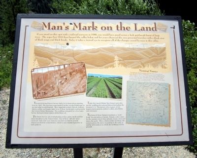
Manís Mark on the Land
The newly formed Forest Service had a lot to learn about planting trees in 1910. The foresters experimented on this ravaged landscape to see what would flourish. They imported walnut, red oak, hickory, cherry, yellow and Japan cedar to see if those hardwoods could grow in the Coeur díAlene Mountains. The seedlings struggled for a few years before the harsh Idaho winters killed them all.
The Forest Service also tried planting cedars, pines, larch and firs from elsewhere in the United States. Few of these “off site” trees survived. Only later was it shown conclusively that local seed sources are best for reforestation, which is now standard practice in such projects.
Today the Coeur d'Alene Tree Nursery provides quality seedlings for national forests throughout the western U.S. The nursery also engages in tree improvement projects related to white pine blister rust resistance.
The Coeur d'Alene Nursery maintains a “seed bank” for our national forests. Forests collect cones for the nursery which then extracts, cleans, tests and stores seeds. When a forest orders seedlings, the nursery grows the stock originating in the same or similar environments in which the seedlings will be planted.
(sidebar)
Naming Names
The Milwaukee Road dotted the map of the Bitterroots with new names like Avery, Stetson and Kyle honoring company bigwigs and the railline itself gave rise to Loop Creek, Motor Creek and St. Paul Pass. Brushy, Cliff, Clear, Bear and Turkey Creeks and the Falcon siding recognize natural features or local animals. The origins of some names such as Roland, Adair and Shefoot are lost.
Topics. This historical marker is listed in these topic lists: Disasters • Horticulture & Forestry • Railroads & Streetcars. A significant historical year for this entry is 1906.
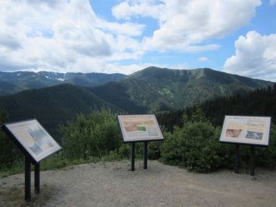
Location. 47° 21.653′ N, 115° 40.081′ W. Marker is near Avery, Idaho, in Shoshone County. Marker can be reached from Cliff Creek Road (Federal Road 506) 2.6 miles north of Loop Creek Road (Federal Road 326). Located along the Route of the Hiawatha Trail. Touch for map. Marker is in this post office area: Avery ID 83802, United States of America. Touch for directions.
Other nearby markers. At least 8 other markers are within walking distance of this marker. Water Does the Work! (a few steps from this marker); A Changing Landscape (a few steps from this marker); Temporary Trestles (approx. 0.7 miles away); Tunneling Toward Tacoma (approx. ĺ mile away); The Toughest Town (approx. 0.9 miles away); World Class Workers (approx. 0.9 miles away); Secluded Falcon (approx. 0.9 miles away); "In the Hole" (approx. 0.9 miles away). Touch for a list and map of all markers in Avery.
More about this marker. On the left is a photo with the caption,, "A white pine planting crew does its back-breaking work above Loop Creek during the 1920s." Photo courtesy of the Museum of Northern Idaho
On the right is a photo of the Coeur d'Alene Tree Nursery. U.S. Forest Service photograph
Also see . . . Route of the Hiawatha Rail Trail. (Submitted on August 4, 2011, by Bernard Fisher of Richmond, Virginia.)
Credits. This page was last revised on February 14, 2020. It was originally submitted on August 4, 2011, by Bernard Fisher of Richmond, Virginia. This page has been viewed 805 times since then and 32 times this year. Photos: 1, 2. submitted on August 4, 2011, by Bernard Fisher of Richmond, Virginia.

