Near Avery in Shoshone County, Idaho — The American West (Mountains)
Water Does the Work!
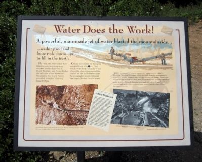
A powerful man-made jet of water blasted the mountainside…
…washing soil and loose rock downslope to fill in the trestle.
By 1911, the Milwaukee Road filled twenty-two temporary wooden trestles between St. Regis, Montana and Avery, Idaho. On this side of the Bitterroot Mountains, two water flumes provided water for "sluicing" these bridges.
Others were filled by dumping material from train cars. You will have to look carefully to see where the sluicing removed the topsoil on the hillsides because the remarkably resilient forest has largely healed the old scars.
With a mighty jet of water, a powerful water cannon called a “Giant” or “monitor” loosened earth and rock from the mountainside above the trestle. Water from a nearby stream ran down a flume into storage tanks several hundred feet above the Giant. Gravity forced the water down a 12-inch diameter pipe and out a 4-inch nozzle. The cannon had no trouble washing great quantities of material from the mountainside.
Topics. This historical marker is listed in this topic list: Railroads & Streetcars. A significant historical year for this entry is 1911.
Location. 47° 21.658′ N, 115° 40.081′ W. Marker is near Avery, Idaho, in Shoshone County. Marker can be reached from Cliff Creek Road (Federal Road 506) 2.6 miles north of Loop Creek Road (Federal Road 326). Located along the Route of the Hiawatha Trail. Touch for map. Marker is in this post office area: Avery ID 83802, United States of America. Touch for directions.
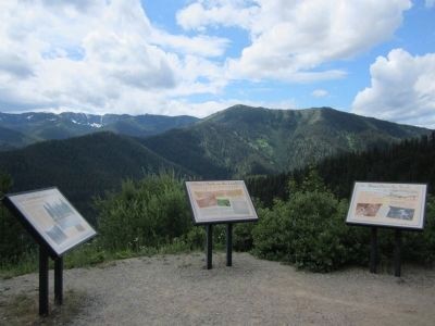
Other nearby markers. At least 8 other markers are within walking distance of this marker. Man’s Mark on the Land (a few steps from this marker); A Changing Landscape (a few steps from this marker); Temporary Trestles (approx. 0.7 miles away); Tunneling Toward Tacoma (approx. ¾ mile away); The Toughest Town (approx. 0.9 miles away); World Class Workers (approx. 0.9 miles away); Secluded Falcon (approx. 0.9 miles away); "In the Hole" (approx. 0.9 miles away). Touch for a list and map of all markers in Avery.
More about this marker. On the lower left is a photo with the caption, "The wooden trestle at the western mouth of Tunnel 21 being filled in 1909. Can you recognize the fill and the tunnel now?"
On the lower right is a photo with the caption, "A Giant washing material into a flume." Photographs courtesy, Montana Historical Society
Also see . . . Route of the Hiawatha Rail Trail. (Submitted on August 4, 2011, by Bernard Fisher of Richmond, Virginia.)
Credits. This page was last revised on June 16, 2016. It was originally submitted on August 4, 2011, by Bernard Fisher of Richmond, Virginia. This page has been viewed 610 times since then and 7 times this year. Photos: 1, 2. submitted on August 4, 2011, by Bernard Fisher of Richmond, Virginia.

