Near Avery in Shoshone County, Idaho — The American West (Mountains)
Temporary Trestles
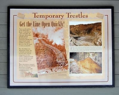
Get the Line Open Quickly!
That was the policy of the Milwaukee Road. To do this in 1907 and 1908, the Chicago, Milwaukee & Puget Sound Railroad built numerous sturdy, but short-lived, wood trestles to prepare the new line for track as soon as possible.
Over the Bitterroot Mountains alone, the railroad constructed twenty-nine of these temporary trestles with a combined length of over 10,000 feet and an average height of about 110 feet.
These structures required the use of about 12 million board feet of timber (enough to build 1,000 average houses)…
Topics. This historical marker is listed in these topic lists: Bridges & Viaducts • Railroads & Streetcars. A significant historical year for this entry is 1907.
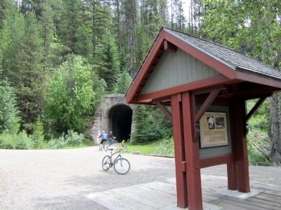
Location. 47° 21.68′ N, 115° 39.154′ W. Marker is near Avery, Idaho, in Shoshone County. Marker can be reached from Cliff Creek Road (Federal Road 506) 1.8 miles north of Loop Creek Road (Federal Road 326). Located along the Route of the Hiawatha Trail. Touch for map. Marker is in this post office area: Avery ID 83802, United States of America. Touch for directions.
Other nearby markers. At least 8 other markers are within 2 miles of this marker, measured as the crow flies. Tunneling Toward Tacoma (a few steps from this marker); Section Gangs (approx. 0.6 miles away); A Changing Landscape (approx. 0.7 miles away); Water Does the Work! (approx. 0.7 miles away); Man’s Mark on the Land (approx. 0.7 miles away); No One’s “Fault” (approx. 0.8 miles away); Bridging the Gaps (approx. one mile away); Little in Name Only (approx. 1.2 miles away). Touch for a list and map of all markers in Avery.
More about this marker. On the left is a photo with the caption, "Busy construction crews erected the Small Creek Trestle outside the west portal of Tunnel #24 during the spring of 1908. A steel trestle replaced it by 1911." Historical photograph courtesy Montana State Historical Society
On the right are two photos with the caption, "Bridge #3, under construction in the photograph above, was later filled with earth. This embankment lasted 87 years until it washed out during a flood in 1995. Approximately 80,00 cubic yards of earth were lost and a by-pass had to be built around the old fill to reopen the trail. The photograph below shows the damage soon after the washout." U.S. Forest Service photograph
Also see . . . Route of the Hiawatha Rail Trail. (Submitted on August 4, 2011, by Bernard Fisher of Richmond, Virginia.)
Credits. This page was last revised on June 16, 2016. It was originally submitted on August 4, 2011, by Bernard Fisher of Richmond, Virginia. This page has been viewed 655 times since then and 11 times this year. Photos: 1, 2. submitted on August 4, 2011, by Bernard Fisher of Richmond, Virginia.

