Near Avery in Shoshone County, Idaho — The American West (Mountains)
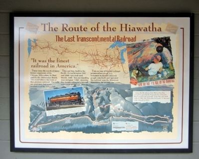
The Route of the Hiawatha
The Last Transcontinental Railroad
“It was the finest railroad in America.”
Those were the words of many former employees of the Chicago, Milwaukee, St. Paul and Pacific (Milwaukee Road). This trail follows the route of that glorious railroad. The rails are gone now, but many reminders of the Milwaukee remain.
This rail line, built to the Pacific Ocean between 1907 and 1909, operated until March, 1980. You are standing near milepost “1763”, meaning this former siding is 1,763 rail miles west of Chicago, Illinois.
This section of the old railroad, preserved as a trail, is a testament to the adventurous people who built and operated the railroad over the Bitterroot Mountains for seventy-one years.
Topics. This historical marker is listed in this topic list: Railroads & Streetcars. A significant historical year for this entry is 1907.
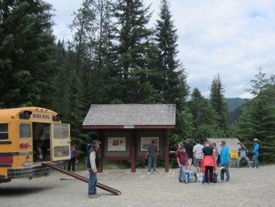
Location. 47° 21.112′ N, 115° 44.192′ W. Marker is near Avery, Idaho, in Shoshone County. Marker can be reached from Moon Pass Road (Federal Road 456) 0.4 miles south of Loop Creek Road (Federal Road 326). Located at the Route of the Hiawatha Trailhead. Touch for map. Marker is in this post office area: Avery ID 83802, United States of America. Touch for directions.
Other nearby markers. At least 8 other markers are within 2 miles of this marker, measured as the crow flies. Not So "Lucky" Swedes (here, next to this marker); The End of the Road? (here, next to this marker); Busy Bogle Spur (a few steps from this marker); Bumps on the Milwaukee Road (approx. 0.4 miles away); Rough Roads & Wrecks (approx. 0.6 miles away); Laboring in Luxury (approx. one mile away); You want to be a Ranger? (approx. 1.1 miles away); Railroad at WAR! (approx. 1˝ miles away). Touch for a list and map of all markers in Avery.
More about this marker. On the lower left is a photo with the caption, "Milwaukee Road history is celebrated and preserved around the United States. Pictured here is Boxcab E57B, the last electric motor used on the line. It’s displayed in downtown Harlowton, Montana."
On the right is a 1946 Milwaukee Road Advertisement
On the bottom is a map with the caption, "Across the flat plains of the Midwest heading toward the great Rocky Mountains the Milwaukee Road spread north westward. From 742 total track miles in 1861, the Milwaukee had nearly 11 thousand miles of track by 1916."
Also see . . . Route of the Hiawatha Rail Trail. (Submitted on August 5, 2011, by Bernard Fisher of Richmond, Virginia.)
Credits. This page was last revised on June 16, 2016. It was originally submitted on August 5, 2011, by Bernard Fisher of Richmond, Virginia. This page has been viewed 722 times since then and 12 times this year. Photos: 1, 2. submitted on August 5, 2011, by Bernard Fisher of Richmond, Virginia.

