Cottonwood Falls in Chase County, Kansas — The American Midwest (Upper Plains)
Cottonwood River Dam
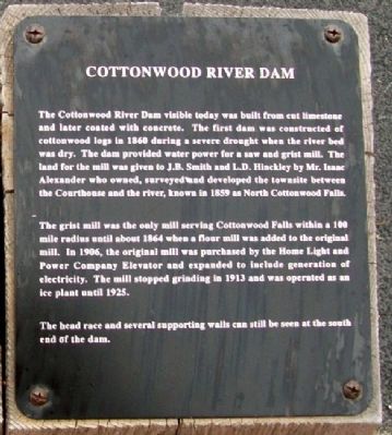
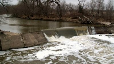
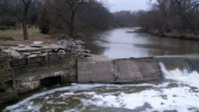
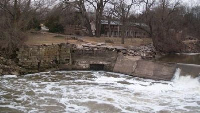
The Cottonwood River Dam visible today was built from cut limestone and later coated with concrete. The first dam was constructed of cottonwood logs in 1860 during a severe drought when the river bed was dry. The dam provided water power for a saw and grist mill. The land for the mill was given to J.B. Smith and L.D. Hinckley by Mr. Isaac Alexander who owned, surveyed and developed the townsite between the Courthouse and the river, known in 1859 as North Cottonwood Falls.
The grist mill was the only mill serving Cottonwood Falls within a 100 mile radius until about 1864 when a flour mill was added to the original mill. In 1906, the original mill was purchased by the Home Light and Power Company Elevator and expanded to include generation of electricity. The mill stopped grinding in 1913 and was operated as an ice plant until 1925.
The head race and several supporting walls can still be seen at the south end of the dam.
Topics. This historical marker is listed in these topic lists: Industry & Commerce • Waterways & Vessels. A significant historical year for this entry is 1860.
Location. 38° 22.516′ N, 96° 32.461′ W. Marker is in Cottonwood Falls, Kansas, in Chase County. Marker is at the north end of the Cottonwood River Bridge, about 400 feet northeast of the intersection of Broadway and Mill Street. Touch for map. Marker is in this post office area: Cottonwood Falls KS 66845, United States of America. Touch for directions.
Other nearby markers. At least 8 other markers are within walking distance of this marker. Cottonwood River Bridges at Cottonwood Falls (here, next to this marker); Bates Grove and the Area Adjacent to the Cottonwood River Dam (here, next to this marker); Chase County and the City of Cottonwood Falls (here, next to this marker); Connecting the Chase County Community (about 400 feet away, measured in a direct line); Oldest Operating Courthouse in Kansas (approx. 0.3 miles away); Chase County War Memorial (approx. 0.3 miles away); A Landmark of Distinction (approx. 0.3 miles away); Chase County All Veterans Memorial (approx. 0.6 miles away). Touch for a list and map of all markers in Cottonwood Falls.
Credits. This page was last revised on December 7, 2021. It was originally submitted on August 5, 2011, by William Fischer, Jr. of Scranton, Pennsylvania. This page has been viewed 675 times since then and 21 times this year. Photos: 1, 2, 3, 4. submitted on August 5, 2011, by William Fischer, Jr. of Scranton, Pennsylvania. 5. submitted on August 6, 2011, by William Fischer, Jr. of Scranton, Pennsylvania.
