Chattanooga in Hamilton County, Tennessee — The American South (East South Central)
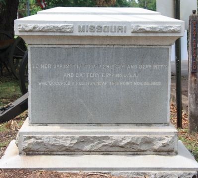
Missouri U.S. Troops Monument
To Her 3rd, 12th, 17th, 27th, 29th, 31st and 32nd Infty.
And Battery F. 2nd Mo. U.S.A.
Who Occupied a Position Near This Point Nov. 25, 1863.
Erected 1895 by the State of Missouri. (Marker Number MT-207.)
Topics and series. This historical marker and monument is listed in this topic list: War, US Civil. In addition, it is included in the Chickamauga and Chattanooga National Military Park, Missionary Ridge, and the Chickamauga and Chattanooga National Military Park: November 25, 1863 series lists. A significant historical date for this entry is November 25, 1863.
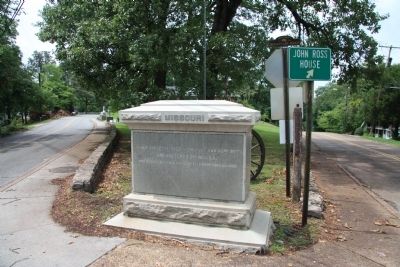
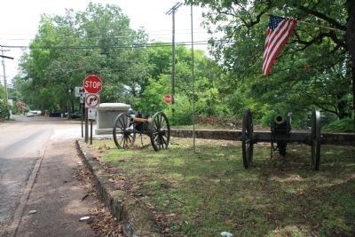
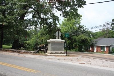
Location. 34° 59.143′ N, 85° 16.39′ W. Marker is in Chattanooga, Tennessee, in Hamilton County. Marker is at the intersection of South Crest Road and West Crest Road, on the right when traveling south on South Crest Road. This historical marker (monument) is located very near the southern end of Missionary Ridge, just north of the Rossville Gap, and a few hundred feet north of the Tennessee - Georgia state border, situated on the southern corner of the intersection along with two artillery field pieces. According to the location information provided by the National Park Service, “Monument located at the intersection of South & West Crest Rds./1934 Map 189". Touch for map. Marker is in this post office area: Chattanooga TN 37404, United States of America. Touch for directions.
Other nearby markers. At least 8 other markers are within walking distance of this marker. Osterhaus' Division (within shouting distance of this marker); Cruft's Division (approx. ¼ mile away in Georgia); 99th Ohio Infantry (approx. ¼ mile away); 40th Ohio Infantry (approx. ¼ mile away); Grose's Brigade (approx. ¼ mile away); Whitaker's Brigade (approx. 0.3 miles away); a different marker also named Cruft's Division (approx. 0.3 miles away); a different marker also named Cruft's Division (approx. 0.3 miles away). Touch for a list and map of all markers in Chattanooga.
More about this monument. According to the description information provided by the National Park Service, the monument is, “6' x 3' x 6' granite monument consists of rectangular slab on two-step base with a projecting capstone. Stones of base are rock-faced, while main slab is polished and inscribed.”
Credits. This page was last revised on September 10, 2020. It was originally submitted on August 7, 2011, by Dale K. Benington of Toledo, Ohio. This page has been viewed 590 times since then and 35 times this year. Photos: 1, 2, 3, 4. submitted on August 7, 2011, by Dale K. Benington of Toledo, Ohio.


