Port Aransas in Nueces County, Texas — The American South (West South Central)
Aransas Pass
C.S.A.
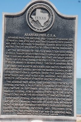
Aransas Pass, The natural inlet (3 miles) to Aransas Bay, separates San Jose and Mustang Islands. These islands are part of a chain of barrier islands which extend along the entire length of Texas' coastal mainland.
At the beginning of the civil war countless small vessels transported Confederate supplies up and down the Texas and Northern Mexican coast virtually undisturbed by Federal Naval Forces. Cotton destined for foreign markets moved freely through Aransas Pass. By early 1861 a Union blockade had halted trafficking by confederate vessels beyond the barrier islands. However, Confederate supplies inside the barrier chain continued and inlets such as Aransas Pass became sites of increasingly strategic military value.
The Aransas Pass area came under the control of Federal Captain J.W. Kittredge's naval forces until his capture in September 1862. In November 1863 a massive Federal force gained control of the South Texas Coast from the Rio Grande to Matagorda Bay.
Eventually, Federal forces lost control of the mainland behind Aransas Pass and in June 1864 withdrew fromt he area. Afterward, Confederate ships successfully eluded the Federal blockade and delivered vital supplies to the Coonfederacy by way of Aransas Pass.
Erected 1995 by Texas Historical Commission . (Marker Number 185.)
Topics. This historical marker is listed in these topic lists: Natural Features • War, US Civil • Waterways & Vessels. A significant historical month for this entry is June 1864.
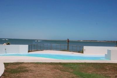
Location. 27° 50.479′ N, 97° 3.786′ W. Marker is in Port Aransas, Texas, in Nueces County. Marker is on Port Street near West Cotter Street, on the right. The marker is located in the City Park of Port Aransas near the ferries. Touch for map. Marker is in this post office area: Port Aransas TX 78373, United States of America. Touch for directions.
Other nearby markers. At least 8 other markers are within 7 miles of this marker, measured as the crow flies. World War II Coastal Defenses at the Aransas Pass (within shouting distance of this marker); Port Aransas Memorial (about 500 feet away, measured in a direct line); Tarpon Inn (approx. 0.3 miles away); Mustang Island (approx. 0.4 miles away); The Mercer Family on Mustang Island (approx. 0.4 miles away); Terminal Railroad (approx. 6.4 miles away); Aransas Pass First Baptist Church (approx. 6.6 miles away); Great Land Lottery of Aransas Pass (approx. 7 miles away). Touch for a list and map of all markers in Port Aransas.
Credits. This page was last revised on July 15, 2022. It was originally submitted on August 8, 2011, by Steve Henderson of Marble Falls, Texas. This page has been viewed 1,004 times since then and 38 times this year. Last updated on July 11, 2022, by Joe Lotz of Denton, Texas. Photos: 1, 2. submitted on August 8, 2011, by Steve Henderson of Marble Falls, Texas. • J. Makali Bruton was the editor who published this page.

