Cascade near Colorado Springs in El Paso County, Colorado — The American Mountains (Southwest)
Pick a Climate
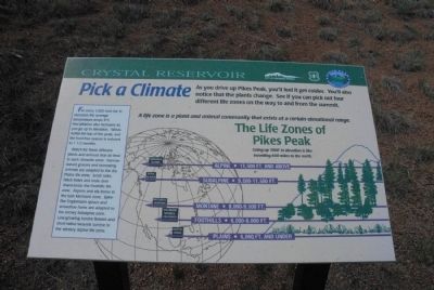
As you drive up Pikes Peak, you’ll feel it get colder. You’ll also notice that the plants change. See if you can pick out four different life zones on the way to and from the summit.
A life zone is a plant and animal community that exists at a certain elevational range. The Life Zones of Pikes Peak. Going up 1000 feet in elevation is like traveling 600 miles to the north. Alpine, 11,500 ft. and above. Subalpine, 9,500-11,000 feet. Montane, 8,000-9,500 feet. Foothills, 6,000-8,000 feet. Plains, 6,000 feet and under.
For every 1,000 foot rise in elevation the average temperature drops 3 degrees F. Precipitation also increases as you go up in elevation. Winds buffet the top of the peak and the frost-free season is reduced to 1½ months.
Watch for these different plants and animals that do best each climactic zone: Narrow-leaved grasses and burrowing animals are adapted to the dry Plains life zone. Scrub oaks, black bears and mule deer characterize the Foothills life zone. Aspens and elk thrive in the lush Montane zone. Spire-like Englemann spruce and snowshoe hares are adapted to the snowy Subalpine zone. Low-growing tundra flowers and short-tailed weasels survive in the wintery Alpine life zone.
Topics. This historical marker is listed in these topic lists: Animals • Environment.
Location. 38° 55.301′ N, 105° 1.549′ W. Marker is near Colorado Springs, Colorado, in El Paso County. It is in Cascade. Marker is on Pike's Peak Toll Road. Marker is located near the Crystal Reservoir Visitor Center. Touch for map. Marker is in this post office area: Cascade CO 80809, United States of America. Touch for directions.
Other nearby markers. At least 8 other markers are within 3 miles of this marker, measured as the crow flies. Well-traveled Water (here, next to this marker); Test Your Bird I.Q. (here, next to this marker); The Making of America's Mountain (here, next to this marker); A Mountain of Many Names (here, next to this marker); Take a Closer Look...Foothills Life Zone (here, next to this marker); Take a Closer Look...Montane Life Zone (here, next to this marker); Take a Closer Look...Alpine/Subalpine Life Zone (here, next to this marker); Welcome to America’s Mountain (approx. 2.4 miles away). Touch for a list and map of all markers in Colorado Springs.
Credits. This page was last revised on February 7, 2023. It was originally submitted on August 10, 2011, by Charles T. Harrell of Woodford, Virginia. This page has been viewed 733 times since then and 10 times this year. Photo 1. submitted on August 10, 2011, by Charles T. Harrell of Woodford, Virginia. • Bill Pfingsten was the editor who published this page.
