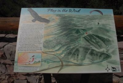
Play in the Wind
Many large birds use these currents to conserve energy. Being lifted into the sky by this wind, called a thermal, is much easier than flapping wings that can span eight feet from tip to tip. Using thermals saves energy and make it easy for birds to travel long distances. The turkey vulture is an expert at utilizing these thermals and are often seen soaring over this area, rarely flapping their wings. Humans now use the same lifting air currents to play in the wind. Hang gliders and paragliders can often be seen here soaring with the raptors, high above the foothills.
Caption
When air moving across the plains hits these mountains, it is forced upward, causing strong updrafts that carry birds and enable humans to feel the wonder of flight.
Topics. This historical marker is listed in these topic lists: Animals • Environment • Sports.
Location. 39° 44.196′ N, 105° 14.726′ W. Marker is near Golden, Colorado, in Jefferson County. Marker is on Lariat Loop Road
Other nearby markers. At least 8 other markers are within walking distance of this marker. Recreation: Past to Present (here, next to this marker); Water Carves Canyons (here, next to this marker); Windy Saddle Park / Connecting to the Past (here, next to this marker); Our Changing Landscape-From Sea Floor to Mountain Top (approx. 0.4 miles away); What You Can See From Here Today (approx. 0.4 miles away); Who Was Buffalo Bill? (approx. 0.4 miles away); Lariat Loop Byway: Buffalo Bill Museum (approx. 0.4 miles away); Lariat Loop Byway: Denver Mountain Parks (approx. 0.4 miles away). Touch for a list and map of all markers in Golden.
Credits. This page was last revised on June 16, 2016. It was originally submitted on August 16, 2011, by Charles T. Harrell of Woodford, Virginia. This page has been viewed 695 times since then and 7 times this year. Photo 1. submitted on August 16, 2011, by Charles T. Harrell of Woodford, Virginia. • Bill Pfingsten was the editor who published this page.
