Near Erie in Neosho County, Kansas — The American Midwest (Upper Plains)
Mission Neosho
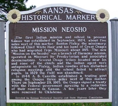
The first Indian mission and school in present Kansas was established in September, 1824, about five miles west of this marker. Benton Pixley, the missionary, followed Chief White Hair and his band of Great Osages who had migrated from Missouri about 1815. The new "Mission on the Neosho" was a branch of Harmony mission, operated in Missouri by Presbyterian and associated denominations. Several Osage tribes located near by, and some of the chiefs and the Indian agent were antagonistic to Pixley. Indian rowdies often disturbed religious meetings and the school failed to attract pupils. In 1829 the field was abandoned.
In 1844 A. B. Canville established a trading post among the Osages three miles west of this marker. There on September 29, 1865, the Osages signed a treaty with the Federal government agreeing to a reduction of their reserve in Kansas. A few years later they were removed to Oklahoma.
Erected by Kansas Historical Society and State Highway Commission. (Marker Number 52.)
Topics and series. This historical marker is listed in these topic lists: Churches & Religion • Education • Government & Politics • Native Americans. In addition, it is included in the Kansas Historical Society series list. A significant historical month for this entry is September 1824.
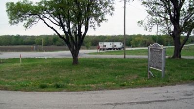
Location. 37° 36.073′ N, 95° 15.091′ W. Marker is near Erie, Kansas, in Neosho County. Marker is at the intersection of Pratt Road (U.S. 59) and 160th Road (Kansas Highway 146), on the right when traveling north on Pratt Road. Marker is near the entrance to Prairie Ridge Golf Course, about two miles north of Erie. Touch for map. Marker is at or near this postal address: 15900 US Highway 59, Erie KS 66733, United States of America. Touch for directions.
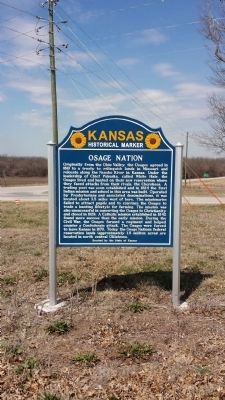
Other nearby markers. At least 8 other markers are within 12 miles of this marker, measured as the crow flies. Osage Nation (here, next to this marker); Veterans Memorial (approx. 2.3 miles away); Lieutenant Leland R. Richey, U.S.N.R. (approx. 2.4 miles away); American Legion Post 102 Veterans Memorial (approx. 2˝ miles away); Civil War Soldiers and Sailors Memorial (approx. 3.2 miles away); War Memorial (approx. 7.1 miles away); Osage Catholic Mission (approx. 7.7 miles away); Chanute Area Veterans Memorial (approx. 11˝ miles away). Touch for a list and map of all markers in Erie.
Regarding Mission Neosho. This marker was replaced in 2012 by the Kansas Historical Marker titled "Osage Nation"
Related marker. Click here for another marker that is related to this marker.
Also see . . .
1. Mission Neosho: The First Kansas Mission. Kansas Historical Quarterly website entry (Submitted on August 18, 2011, by William Fischer, Jr. of Scranton, Pennsylvania.)
2. Neosho County, Kansas. Kansapedia website entry (Submitted on August 18, 2011, by William Fischer, Jr. of Scranton, Pennsylvania.)
3. The Osage Nation. Tribe website homepage (Submitted on August 18, 2011, by William Fischer, Jr. of Scranton, Pennsylvania.)
Credits. This page was last revised on January 26, 2022. It was originally submitted on August 18, 2011, by William Fischer, Jr. of Scranton, Pennsylvania. This page has been viewed 809 times since then and 37 times this year. Photos: 1. submitted on August 18, 2011, by William Fischer, Jr. of Scranton, Pennsylvania. 2. submitted on March 27, 2015, by Ryan Purcell of Topeka, Kansas. 3. submitted on August 18, 2011, by William Fischer, Jr. of Scranton, Pennsylvania.


