Coulterville in Mariposa County, California — The American West (Pacific Coastal)
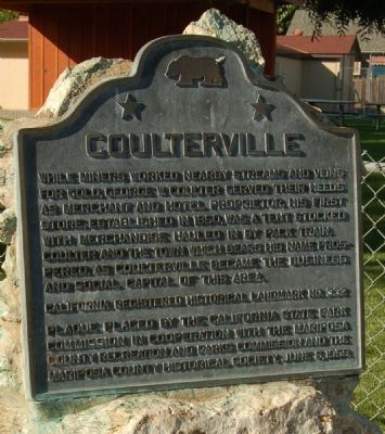
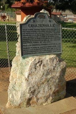
Coulterville
While miners worked nearby streams and veins for gold, George W. Coulter served their needs as merchant and hotel proprietor. His first store, established in 1850, was a tent stocked with merchandise hauled in by pack train. Coulter and the town which bears his name prospered as Coulterville became the business and social capital of the area.
Erected 1959 by California State Park Commission, Mariposa County Rrecreation and Parks Commission and the Mariposa County Historical Society. (Marker Number 332.)
Topics and series. This historical marker is listed in these topic lists: Industry & Commerce • Settlements & Settlers • Waterways & Vessels. In addition, it is included in the California Historical Landmarks series list. A significant historical year for this entry is 1850.
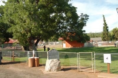
Location. 37° 42.683′ N, 120° 11.853′ W. Marker is in Coulterville, California, in Mariposa County. Marker is on State Highway 49, on the left when traveling south. The marker is located on the Northeast side of Highway 49 between Main Street and Broadway, in front of Coulterville Park. Touch for map. Marker is in this post office area: Coulterville CA 95311, United States of America. Touch for directions.
Other nearby markers. At least 8 other markers are within walking distance of this marker. A different marker also named Coulterville (within shouting distance of this marker); Whistling Billy (within shouting distance of this marker); Jeffery Hotel (within shouting distance of this marker); Historic Walls (within shouting distance of this marker); Coulterville Hotel (about 400 feet away, measured in a direct line); The Mint (about 400 feet away); I.O.O.F Lodge 104 (about 700 feet away); Sun Sun Wo Co. (approx. 0.3 miles away). Touch for a list and map of all markers in Coulterville.
Also see . . . History of Coulterville. Ghost Towns of Mariposa County website entry:
The mining camp was also known as Bandarita, Bandereta, Matsell’s Creek, Maxwell’s Creek and Maxwellville (Submitted on August 21, 2011, by Barry Swackhamer of Brentwood, California.)
Credits. This page was last revised on March 10, 2022. It was originally submitted on August 21, 2011, by Barry Swackhamer of Brentwood, California. This page has been viewed 818 times since then and 9 times this year. Photos: 1, 2, 3. submitted on August 21, 2011, by Barry Swackhamer of Brentwood, California. • Syd Whittle was the editor who published this page.


