Near Mariposa in Mariposa County, California — The American West (Pacific Coastal)
The Ophir Mines
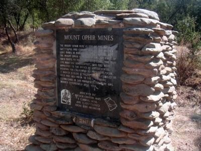
Inscription.
The Mount Ophir Mine is one of the most successful and conspicuous of the Mother Lode mines in Mariposa County. It includes the Mount Ophir Mint which was the first of such mints to turn gold into coins. The Mint was built by John Moffitt, who had been appointed to the Office of United States Assayer for California by President Tyler. It minted $50.00 octagonal coins (slugs) in 1850 and 1851 prior to the Mint being established in San Francisco. The mine was worked extensively until 1914.
Erected 1997 by Matuca Chapter 1849, E Clampus Vitus.
Topics and series. This historical marker is listed in these topic lists: Industry & Commerce • Natural Resources. In addition, it is included in the E Clampus Vitus, and the Former U.S. Presidents: #10 John Tyler series lists. A significant historical year for this entry is 1850.
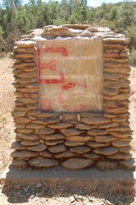
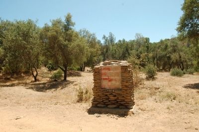
Location. Marker has been reported missing. It was located near 37° 30.871′ N, 120° 3.986′ W. Marker was near Mariposa, California, in Mariposa County. Marker was on Mount Ophir Road. The Mt. Ophir Road parallels California Highway 49 and has two entrances. The marker is closer to the southern entrance. Touch for map. Marker was in this post office area: Mariposa CA 95338, United States of America. Touch for directions.
Other nearby markers. At least 8 other markers are within 5 miles of this location, measured as the crow flies. La Mineta 1850 - Princeton 1854 - Mount Bullion 1862 (approx. 1.3 miles away); May Rock (approx. 2.7 miles away); The Townsite of Agua Fria, California (approx. 3.2 miles away); Agua Fria (approx. 3.8 miles away); a different marker also named Agua Fria (approx. 3.8 miles away); Bear Valley (approx. 4.7 miles away); a different marker also named Bear Valley (approx. 4.7 miles away); Mrs. E. Trabucco Store (approx. 4.8 miles away). Touch for a list and map of all markers in Mariposa.
More about this marker. The marker was recorded in place in 2008. There are two errors on this marker that may account for it being missing. First, Moffitt is misspelled, it should be Moffat. Second, the $50 octagonal gold coin (slugs) that the marker refers to were actually minted by August Humbert.
Also see . . .
1. Mt. Ophir Mine Mariposa. This is a Youtube video clip. (Submitted on August 22, 2011, by Barry Swackhamer of Brentwood, California.)
2. The Story of Moffat and Co. Gold Coins. (Submitted on August 22, 2011, by Barry Swackhamer of Brentwood, California.)
Additional commentary.
1. My Childhood
To find a Mount Ophir site on the Internet is fascinating to me!!! My father was a geography professor at Fresno State University (now CSUF) and I grew up on his 1 & 3 day field trips to the "Mother Lode" as a kid. Harry Odgers used to tell us stories about the old days when my father researched new aspects to his teachings. A very interesting guy! When he would he return to the mine the next day, the dust would have lowered to about waist height (like an odd fog) as opposed to an all consuming haze. I have been to the mine many times over my early life and always thought of Harry. It was always an ugly poison oak covered trail to get to the place but the tribulation was always worth it.
CJ
— Submitted November 9, 2013, by Christian Scott Johnson of Fresno, California.

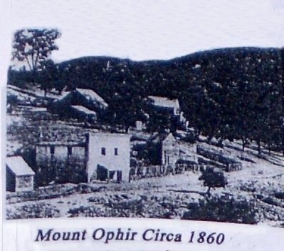
Photographed By Unknown, circa 1860
4. Mount Ophir
Originally the town of Ophir, it was established by Mexican Miners in 1848. It was renamed Mount Ophir in 1856. In 1858 it was a bustling gold mine community with 3 working stamp mills in operation.
The photo is from a pamphlet printed by E Clampus Vitus in 2010
The photo is from a pamphlet printed by E Clampus Vitus in 2010
Credits. This page was last revised on June 16, 2016. It was originally submitted on August 22, 2011, by Barry Swackhamer of Brentwood, California. This page has been viewed 1,638 times since then and 84 times this year. Photos: 1. submitted on February 20, 2012, by Lester J Letson of Fresno, California. 2, 3. submitted on August 22, 2011, by Barry Swackhamer of Brentwood, California. 4. submitted on February 21, 2012, by Lester J Letson of Fresno, California. • Syd Whittle was the editor who published this page.


