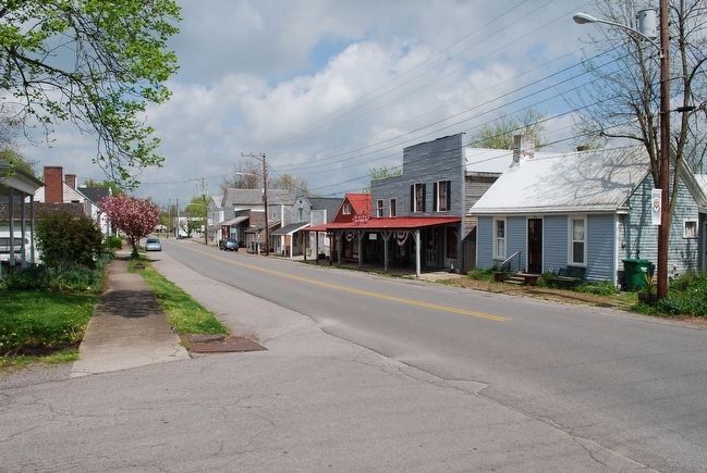
Perryville in Boyle County, Kentucky — The American South (East South Central)
Merchants' Row / Street Fighting
(obverse)
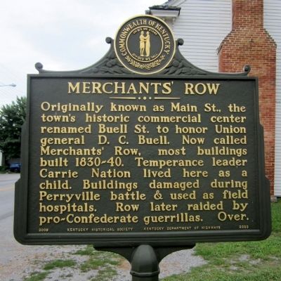
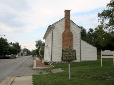
Merchants' Row
Originally known as Main St., the town's historic commercial center renamed Buell St. to honor Union general D.C. Buell. Now called Merchants' Row, most buildings built 1830-40. Temperance leader Carrie Nation lived here as a child. Buildings damaged during Perryville battle & used as field hospitals. Row later raided by pro-Confederate guerillas. Over.
(reverse)
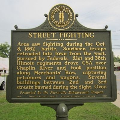
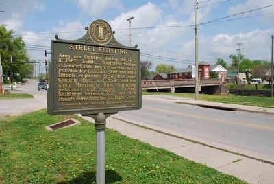
Street Fighting
Area saw fighting during the Oct. 8, 1862 battle. Southern troops retreated into town from the west pursued by Federals. 21st and 38th Illinois regiments drove CSA over Chaplin River and took position along Merchants' Row, capturing prisoners and wagons. Several buildings between 2nd and 3rd streets burned during the fight. Over.
Erected 2006 by Kentucky Historical Society and Kentucky Department of Highways. (Marker Number 2223.)
Topics and series. This historical marker is listed in these topic lists: Industry & Commerce • War, US Civil. In addition, it is included in the Kentucky Historical Society series list. A significant historical year for this entry is 1862.
Location. 37° 39.004′ N, 84° 57.111′ W. Marker is in Perryville, Kentucky, in Boyle County. Marker is at the intersection of South Buell Street (U.S. 68) and West Second Street (U.S. 150), on the right when traveling south on South Buell Street. Touch for map. Marker is in this post office area: Perryville KY 40468, United States of America. Touch for directions.
Other nearby markers. At least 8 other markers are within walking distance of this marker. Battle of Perryville (within shouting distance of this marker); a different marker also named The Battle of Perryville (within shouting distance of this marker); Bragg's Invasion of Kentucky (about 300 feet away, measured in a direct line); Perryville (about 300 feet away); The City of Perryville (about 300 feet away); “If You Meet the Enemy, Overpower Him” (about 300 feet away); Perryville in the Crucible of War (about 400 feet away); a different marker also named Battle of Perryville (about 400 feet away). Touch for a list and map of all markers in Perryville.
Credits. This page was last revised on November 2, 2021. It was originally submitted on August 23, 2011, by Bernard Fisher of Richmond, Virginia. This page has been viewed 1,115 times since then and 35 times this year. Photos: 1, 2, 3. submitted on August 23, 2011, by Bernard Fisher of Richmond, Virginia. 4, 5. submitted on September 15, 2015, by Brandon Fletcher of Chattanooga, Tennessee.
