Near Mariposa in Mariposa County, California — The American West (Pacific Coastal)
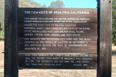
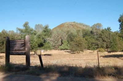
The Townsite of Agua Fria, California
This mining town became the seat of justice of Mariposa County when on February 18,1850, the State Legislature divided the state into 27 counties. Mariposa County the comprised one-fifth of the entire state and included what are Mariposa, Tulare, Merced, Fresno, Kern, Madera, and portions of Los Angeles, San Bernardino, Inyo, Mono, and San Benito Counties. As a result of election on September 3, 1851, Mariposa became the seat of government on November 10, 1851.
Aqua Fria overlays the town’s main street. On June 22, 1866, the entire town, about 75 buildings, was consumed by fire. The residents did not own the land, hence the town was never re-built.
Revised 1990
Erected 1990.
Topics. This historical marker is listed in this topic list: Settlements & Settlers. A significant historical month for this entry is February 1849.
Location. 37° 29.238′ N, 120° 1.17′ W. Marker is near Mariposa, California, in Mariposa County. Marker is on Aqua Fria Road, 0.4 miles north of California Highway 140, on the left when traveling north. Touch for map. Marker is at or near this postal address: 5086 Aqua Fria Road, Mariposa CA 95338, United States of America. Touch for directions.
Other nearby markers. At least 8 other markers are within 3 miles of this marker, measured as the crow flies. Agua Fria (approx. 0.6 miles away); a different marker also named Agua Fria (approx. 0.6 miles away); La Mineta 1850 - Princeton 1854 - Mount Bullion 1862 (approx. 1.9 miles away); Mariposa Museum and History Center (approx. 2.7 miles away); Mariposa County Court House (approx. 2.9 miles away); A Shrine to Justice in California (approx. 2.9 miles away); a different marker also named Mariposa County Court House (approx. 2.9 miles away); Mariposa County Courthouse (approx. 2.9 miles away). Touch for a list and map of all markers in Mariposa.
Also see . . .
1. Agua Fria, California. Western Mining History website entry (Submitted on March 18, 2022, by Larry Gertner of New York, New York.)
2. Ghosttowns: Aqua Fria. (Submitted on August 23, 2011, by Barry Swackhamer of Brentwood, California.)
Credits. This page was last revised on March 18, 2022. It was originally submitted on August 23, 2011, by Barry Swackhamer of Brentwood, California. This page has been viewed 938 times since then and 35 times this year. Photos: 1, 2. submitted on August 23, 2011, by Barry Swackhamer of Brentwood, California. • Syd Whittle was the editor who published this page.

