Madison Heights in Amherst County, Virginia — The American South (Mid-Atlantic)
Amherst County / Campbell County
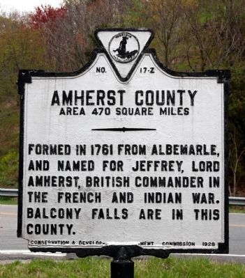
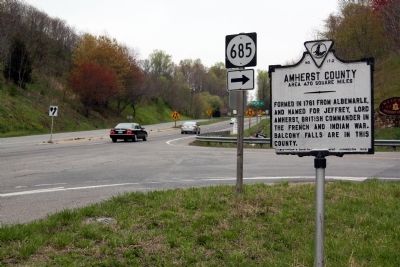
Amherst County. Area 470 Square Miles. Formed in 1761 from Albemarle, and named for Jeffrey, Lord Amherst, British commander in the French and Indian War. Balcony Falls are in this county.
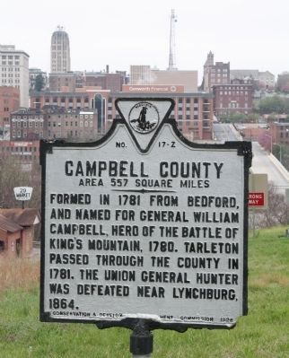
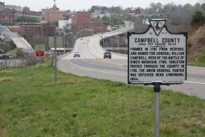
Campbell County. Area 557 Square Miles. Formed in 1781 from Bedford, and named for General William Campbell, hero of the Battle of King’s Mountain, 1780. Tarleton passed through the county in 1781. The Union General Hunter was defeated near Lynchburg, 1864.
Erected 1928 by Conservation & Development Commission. (Marker Number Z-17.)
Topics and series. This historical marker is listed in this topic list: Political Subdivisions. In addition, it is included in the Virginia Department of Historic Resources (DHR) series list. A significant historical year for this entry is 1761.
Location. 37° 25.199′ N, 79° 8.2′ W. Marker is in Madison Heights, Virginia, in Amherst County. Marker is at the intersection of South Amherst Highway (Virginia Route 163) and River Road (County Route 685), on the right when traveling north on South Amherst Highway. Touch for map. Marker is in this post office area: Madison Heights VA 24572, United States of America. Touch for directions.
Other nearby markers. At least 8 other markers are within walking distance of this marker. Williams Viaduct (about 500 feet away, measured in a direct line); Civil War Lynchburg (approx. 0.4 miles away); Point of Honor (approx. 0.4 miles away); Nuclear Ship Savannah (approx. half a mile away); Lynchburg History (approx. half a mile away); The Ladies Relief Hospital (approx. half a mile away); Point of Beginning (approx. half a mile away); a different marker also named The Ladies Relief Hospital (approx. half a mile away).
More about this marker. This marker was probably moved a few hundred feet—but no more—when the new bridge replaced the Williams Viaduct that originally carried this roadway across the James River and into Lynchburg. Early marker guidebooks show it on State Route 18 and this roadway was Route 18. It later became U.S. 29, then Route 29 was moved to the first bypass and this roadway became Business Route 29. Then when the new Route 29 bypass was built in the 2000s it became
State Route 193, where the marker is now found.
The nearest Cambell County comes to this marker is 3 miles, as the crow flies, or 7 miles if you continue driving south on this route. The marker is on the Amherst-Lynchburg line, not the Amherst-Campbell line. Lynchburg, like all cities in Virginia, is independent from the surrounding county. The marker was erected in 1928 and the latest city charter for Lynchburg was adopted in 1928, after the marker was erected. Perhaps Lynchburg was not officially an independent city when the marker was first erected. Or perhaps the city boundaries have expanded since 1928 and, when it was erected, the Williams Viaduct crossed a little piece of Campbell County before it landed on 7th Street in Lynchburg.
Credits. This page was last revised on July 3, 2021. It was originally submitted on August 23, 2011, by J. J. Prats of Powell, Ohio. This page has been viewed 529 times since then and 17 times this year. Photos: 1, 2, 3, 4. submitted on August 24, 2011, by J. J. Prats of Powell, Ohio.


