St. Johns Bluff in Jacksonville in Duval County, Florida — The American South (South Atlantic)
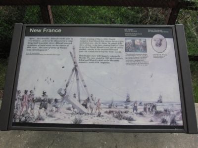
New France
Fort Caroline National Monument
— Timucuan Ecological and Historic Preserve —
René de Laundonnière, 1564, Second-in-command during Jean Ribault's 1562 voyage.
On the morning of May 1, 1562, French navigator Jean Ribault first viewed the river you see before you - the St. Johns. He named it the River of May. A day later, staking France's claim to the New World, Ribault's men placed a stone marker - similar to the monument behind you - on a sandy knoll near the river's mouth.
Thus began a race with Spain to colonize la Florida. The race ended in 1565 with France's defeat and Ribault's death at the Matanzas massacre, south of St. Augustine.
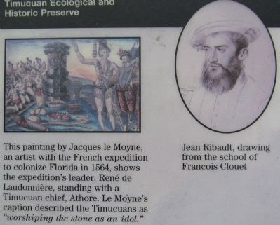
(Caption at upper right):
This painting by Jacques le Moyne, an artist with the French expedition to colonize Florida in 1564, shows the expedition's leader, René de Laundonnière, standing with a Timucuan chief, Athore. Le Moyne's caption described the Timucuans as "worshiping the stone as an idol."
Erected by National Park Service - U.S. Department of the Interior.
Topics. This historical marker is listed in this topic list: Colonial Era. A significant historical date for this entry is May 1, 1562.
Location. 30° 23.293′ N, 81° 29.367′ W. Marker is in Jacksonville, Florida, in Duval County. It is in St. Johns Bluff. Marker is on Ft. Caroline Road, on the left when traveling east. Located at the overlook for the Ribault Memorial (accessed from a driveway off Ft. Caroline Road) in the Timucuan Ecological and Historic Preserve. Touch for map. Marker is in this post office area: Jacksonville FL 32225, United States of America. Touch for directions.
Other nearby markers. At least 8 other markers are within walking distance of this marker. Timucuan Preserve (here, next to this marker); Ribault Monument (here, next to this marker); Staking a Claim (within shouting distance of this marker); Spanish Pond (approx. half a mile away); The River of May (approx. half a mile away); Timucuan Friends (approx. 0.6 miles away); The Building of la Caroline (approx. 0.6 miles away); Fort de la Caroline (approx. 0.7 miles away). Touch for a list and map of all markers in Jacksonville.
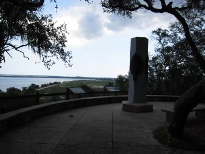
Also see . . . Ribault Monument. The monument is a replica of the stone placed by Ribault. (Submitted on August 27, 2011, by Craig Swain of Leesburg, Virginia.)
Credits. This page was last revised on February 3, 2023. It was originally submitted on August 27, 2011, by Craig Swain of Leesburg, Virginia. This page has been viewed 745 times since then and 7 times this year. Photos: 1, 2, 3. submitted on August 27, 2011, by Craig Swain of Leesburg, Virginia.


