McGregor in Clayton County, Iowa — The American Midwest (Upper Plains)
Bat Caves
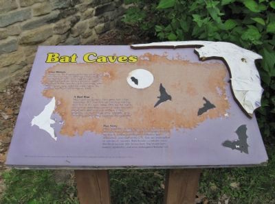
Cave History
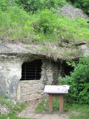
Workers for the Hagensieck brewery created these cave openings around 1867 using picks, shovels and blasting powder. They used the caves to store ice and beer until the brewery closed in 1888. Hundreds of bats used the caves until 1986, when the entrances were sealed for public safety. An entrance was reopened for bats in 1998.
A Bad Rap
Myths and superstitions have given bats a bad reputation. But most bats are harmless and less than 1/2 of 1% carry rabies. Bats are the major predator of night-flying insects; a single bat can eat about 1,200 insects in an hour. Using ultrasonic signals to locate prey, navigate, and communicate, bats have mastered the night sky.
Bat Stats
More than 900 species of bats occur worldwide, 45 of which live in the continental United States. Due to the loss of habitat and human disturbance and destruction, over half of the U.S. bats are endangered or species of concern. Bats known to inhabit caves like these include little brown bats, big brown bats, eastern pipistrelles, and even endangered Indiana bats.
Bat artwork reprinted with permission from Bat Conservation International and the University of Missouri Press.
Topics. This historical marker is listed in these topic lists: Animals • Industry & Commerce. A significant historical year for this entry is 1867.
Location. 43° 1.894′ N, 91° 10.492′ W. Marker is in McGregor, Iowa, in Clayton County. Marker can be reached from River Street (Business U.S. 18) 0.4 miles north of Front Street, on the left when traveling north. Marker is on the property of the McGregor District Office of the U.S. Fish & Wildlife Service, Upper Mississippi River National Wildlife and Fish Refuge. Touch for map. Marker is at or near this postal address: 401 Business US Highway 18 North, Mc Gregor IA 52157, United States of America. Touch for directions.
Other nearby markers. At least 8 other markers are within 2 miles of this marker, measured as the crow flies. McGregor / Ringling Brothers (approx. half a mile away); Smoke stacks and paddle wheels (approx. 1.6 miles away in Wisconsin); Fort Crawford (approx. 1.6 miles away in Wisconsin); Site of the Second Fort Crawford (approx. 1.6 miles away in Wisconsin); Black Hawk's Surrender (approx. 1.6 miles away in Wisconsin); William Beaumont, M. D. (approx. 1.6 miles away in Wisconsin); Pere Marquette and Sieur Jolliet (approx. 1.8 miles away in Wisconsin); Prairie du Chien (approx. 1.8 miles away in Wisconsin).
Also see . . . Bat. Wikipedia entry. (Submitted on September 1, 2011.)
Additional keywords. J. L. Hagensick Brewery
Credits. This page was last revised on November 16, 2020. It was originally submitted on September 1, 2011, by Keith L of Wisconsin Rapids, Wisconsin. This page has been viewed 903 times since then and 15 times this year. Photos: 1, 2. submitted on September 1, 2011, by Keith L of Wisconsin Rapids, Wisconsin.

