Boscobel in Grant County, Wisconsin — The American Midwest (Great Lakes)
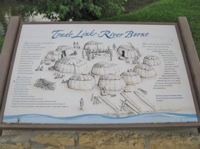
Trade Links – River Borne
The Native American found a land of many possibilities. Animals such as mammoth, mastodon, moose, and giant beaver lived in the surrounding forests. For thousands of years, the Wisconsin River was an important transportation corridor for ideas and goods.
Around 2000 years ago, Native American farmers, traders, and extraordinary craftsmen living along rivers in Illinois, Ohio, and Wisconsin began trading their fine pottery, stone knives, and other works of art throughout the Midwest.
Wisconsin's Native Americans adapted many new technologies, including the manufacture of pottery for cooking and food storage, the use of the bow and arrow in hunting small animals, and the cultivation of wild plants, corn, beans, and squash. These changes resulted in a more settled village life.
About 1700 years ago, Native Americans built a village on the south bank of the Wisconsin River in Grant County.
Archaeologists call the village Millville. The houses at Millville are the only ones that have been discovered from this time period in Southwestern Wisconsin. Millville also has early evidence of plant cultivation (squash, domesticated sunflower, and sumpweed). The villagers gathered wild rice, nuts, seeds, and berries, and continued to hunt animals such as elk and white-tailed deer.
This artist's drawing of the Millville village is based on information from the archaeological excavation.
Erected by the Wisconsin Department of Transportation and the Wisconsin Historical Society.
Topics. This historical marker is listed in these topic lists: Industry & Commerce • Native Americans • Waterways & Vessels. A significant historical year for this entry is 2000.
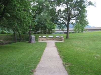
Location. 43° 8.98′ N, 90° 42.896′ W. Marker is in Boscobel, Wisconsin, in Grant County. Marker can be reached from Elm Street (U.S. 61) 0.3 miles south of State Highway 60, on the left when traveling north. Marker is at the Floyd Von Haden Boat Landing & Recreation Area. Touch for map. Marker is in this post office area: Boscobel WI 53805, United States of America. Touch for directions.
Other nearby markers. At least 8 other markers are within 14 miles of this marker, measured as the crow flies. The River (here, next to this marker); Boscobel - A River Town (here, next to this marker); Crossing the River (here, next to this marker); The Gideons (approx. 2.2 miles away); The "Dinky" (approx. 11.7 miles away); Beauford T. Anderson (approx. 12.4 miles away); Gays Mills Apple Orchards
(approx. 13.1 miles away); Gays Mills Sesquicentennial (approx. 13˝ miles away). Touch for a list and map of all markers in Boscobel.
Credits. This page was last revised on June 16, 2016. It was originally submitted on September 2, 2011, by Keith L of Wisconsin Rapids, Wisconsin. This page has been viewed 576 times since then and 18 times this year. Photos: 1, 2. submitted on September 2, 2011, by Keith L of Wisconsin Rapids, Wisconsin.

