Merriam in Johnson County, Kansas — The American Midwest (Upper Plains)
The Founding of Campbellton
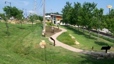
Merriam Historic Plaza Walking Path
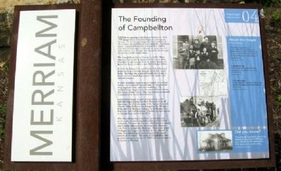
With the opening of the Kansas Territory in 1854, people from everywhere began to converge on Kansas. The fertile and inexpensive land available in the territory attracted David Gee Campbell, a Tennessee native. Campbell loaded his wife and their children into two covered wagons and made the journey to the new territory. It is thought that Campbell also brought his parents and his former slaves.
The Campbells settled in Shawnee in 1860. When Shawnee was burned by Quantrill’s Raiders in 1864, Campbell bought acreage from an Indian family and moved his house to what is now 9503 Johnson Drive.
In 1867 the Kansas City and Neosho Valley Railroad began building a railroad through the Turkey Creek basin. Knowing that a railroad could either make or break a town, Campbell gave part of his land to the railroad company.
A small settlement began to grow around the railroad station, and Campbell donated land for a blacksmith shop, a general store, and other buildings. The settlement was originally on the south side of Johnson Drive near Turkey Creek. This community was named Campbellton in honor of its founder.
Campbellton began to grow in population as the railroads began moving out from Kansas City in all directions. In 1868 the name of the Kansas City and Neosho Valley Railroad was changed to the Missouri River and Gulf Railroad and later to Kansas City, Fort Scott and Gulf Railroad. The first railroad station in Campbellton was built in 1870.
After the railroad was completed, an addition was made to the land originally purchased by David Campbellton. This new section was called Merriam, named after Charles Merriam, the Secretary of the Kansas City, Fort Scott and Gulf Railroad. He was the major developer and biggest stockholder in the railroad. In time, this addition grew until it became the major portion of the town. The name of Campbellton was gradually dropped, and in the 1880’s the town began to be known as Merriam.
About the Images
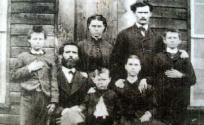
David Gee Campbell family -
Seated are David Gee Campbell and his wife America Victoria, from left are children David Edward, Nancy Alice, Reuben, James Marion, and Frederick Chouteau. Not pictured is son George Hannibal.
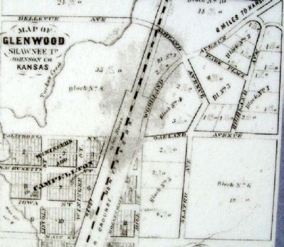
Campbellton Map -
The 1874 map from the Johnson County Atlas illustrating Campbellton with railroad and depot noted.
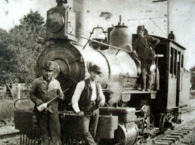
The Steam Engine -
The Steam Engine or "Iron Horse" played a major role in the development of Merriam through the railway system.
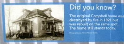
Did you know?
The original Campbell home was destroyed by fire in 1891 but was rebuilt on the same spot. The home still stands today.
Erected
2006 by City of Merriam. (Marker Number 04.)
Topics. This historical marker is listed in these topic lists: Industry & Commerce • Railroads & Streetcars • Settlements & Settlers. A significant historical year for this entry is 1854.
Location. 39° 0.872′ N, 94° 41.442′ W. Marker is in Merriam, Kansas, in Johnson County. Marker is at the Merriam Visitors Bureau, near Exit #228B of Interstate 35, and immediately southwest of the intersection of Shawnee Mission Parkway (US 56) and Eby Avenue. Touch for map. Marker is at or near this postal address: 6304 East Frontage Road, Mission KS 66202, United States of America. Touch for directions.
Other nearby markers. At least 8 other markers are within walking distance of this marker. The Overland Trails (here, next to this marker); Merriam Park & George Kessler (here, next to this marker); Shawnee Friends Mission (a few steps from this marker); The Trolley Line & Hocker Grove Amusement Park (a few steps from this marker); The People of the South Wind & the Coming of the Shawnee (a few steps from this marker); The Bear Pit (within shouting distance of this marker); Education in Merriam (within shouting distance of this marker); The South Park Community (within shouting distance of this marker). Touch for a list and map of all markers in Merriam.
Also see . . . Explore Merriam, Kansas. City website homepage (Submitted on September 5, 2011, by William Fischer, Jr. of Scranton, Pennsylvania.)
Credits. This page was last revised on October 11, 2022. It was originally submitted on September 4, 2011, by William Fischer, Jr. of Scranton, Pennsylvania. This page has been viewed 842 times since then and 43 times this year. Photos: 1, 2, 3, 4, 5, 6. submitted on September 5, 2011, by William Fischer, Jr. of Scranton, Pennsylvania. 7. submitted on September 6, 2011, by William Fischer, Jr. of Scranton, Pennsylvania.
