Merriam in Johnson County, Kansas — The American Midwest (Upper Plains)
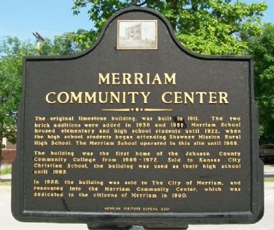
Merriam Community Center
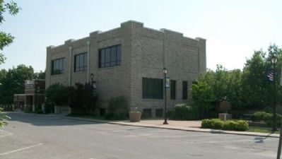
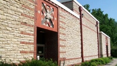
The original limestone building, was built in 1911. The two brick additions were added in 1938 and 1951. Merriam School housed elementary and high school students until 1922, when the high school students began attending Shawnee Mission Rural High School. The Merriam School operated in the site until 1969.
The building was the first home of the Johnson County Community College from 1969-1972. Sold to Kansas City Christian School, the building was used as their high school until 1985.
In 1988, the building was sold to The City of Merriam, and renovated into the Merriam Community Center, which was dedicated to the citizens of Merriam in 1990.
Erected 2001 by Merriam Visitors Bureau.
Topics. This historical marker is listed in this topic list: Education. A significant historical year for this entry is 1911.
Location. 39° 1.536′ N, 94° 41.575′ W. Marker is in Merriam, Kansas, in Johnson County. Marker is on Kessler Lane near West 57th Street, on the left when traveling north. Touch for map. Marker is at or near this postal address: 5701 Merriam Drive, Mission KS 66202, United States of America. Touch for directions.
Other nearby markers. At least 8 other markers are within walking distance of this marker. Campbell Home (approx. ¼ mile away); The Overland Trails (approx. ¾ mile away); Shawnee Friends Mission (approx. ¾ mile away); The Founding of Campbellton (approx. 0.8 miles away); The Bear Pit (approx. 0.8 miles away); The Trolley Line & Hocker Grove Amusement Park (approx. 0.8 miles away); The People of the South Wind & the Coming of the Shawnee (approx. 0.8 miles away); Education in Merriam (approx. 0.8 miles away). Touch for a list and map of all markers in Merriam.
Also see . . . Explore Merriam, Kansas. (Submitted on September 5, 2011, by William Fischer, Jr. of Scranton, Pennsylvania.)
Credits. This page was last revised on January 6, 2022. It was originally submitted on September 5, 2011, by William Fischer, Jr. of Scranton, Pennsylvania. This page has been viewed 630 times since then and 15 times this year. Photos: 1, 2, 3, 4. submitted on September 5, 2011, by William Fischer, Jr. of Scranton, Pennsylvania.


