Near Georgetown in Williamson County, Texas — The American South (West South Central)
Mankins Crossing
(100 yards west)
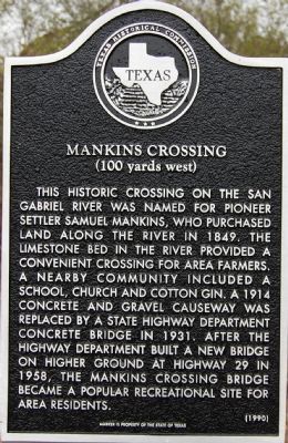
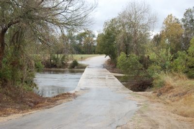
This historic crossing on the San Gabriel River was named for pioneer settler Samuel Mankins, who purchased land along the river in 1849. The limestone bed in the river provided a convenient crossing for area farmers. A nearby community included a school, church, and cotton gin. A 1914 concrete and gravel causeway was replaced by a State Highway Department concrete bridge in 1931. After the Highway Department built a new bridge on higher ground at Highway 29 in 1958, the Mankins Crossing bridge became a popular recreational site for area residents.
Erected 1990 by Texas Historical Commission. (Marker Number 9307.)
Topics. This historical marker is listed in this topic list: Bridges & Viaducts. A significant historical year for this entry is 1849.
Location. 30° 38.798′ N, 97° 34.958′ W. Marker is near Georgetown, Texas, in Williamson County. Marker is on County Road 100. Touch for map. Marker is in this post office area: Georgetown TX 78626, United States of America. Touch for directions.
Other nearby markers. At least 8 other markers are within 4 miles of this marker, measured as the crow flies. The Double File Trail (Georgetown) (approx. 0.6 miles away); Texan Santa Fe Expedition (approx. 0.6 miles away); Weir Community Cemetery (approx. 1.1 miles away); City of Weir (approx. 2 miles away); Community of Jonah (approx. 2˝ miles away); Pennington Family Cemetery (approx. 3.4 miles away); Site of Neusser (Naizerville) (approx. 3˝ miles away); Jesse Cooper House (approx. 3.8 miles away). Touch for a list and map of all markers in Georgetown.
Credits. This page was last revised on November 29, 2020. It was originally submitted on January 12, 2008, by Keith Peterson of Cedar Park, Texas. This page has been viewed 1,595 times since then and 93 times this year. Photos: 1. submitted on January 12, 2008, by Keith Peterson of Cedar Park, Texas. 2. submitted on February 26, 2015, by QuesterMark of Fort Worth, Texas. 3. submitted on March 24, 2018, by Keith Peterson of Cedar Park, Texas. 4. submitted on January 13, 2008, by Keith Peterson of Cedar Park, Texas. • Craig Swain was the editor who published this page.


