Topeka in Shawnee County, Kansas — The American Midwest (Upper Plains)
The Capitol Building
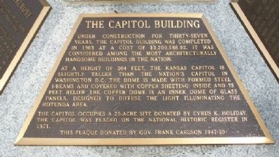
Under construction for thirty-seven years, the Capitol building was completed in 1903 at a cost of $3,200,588.92. It was considered among the most architecturally handsome buildings in the nation.
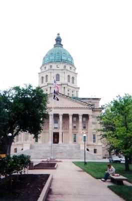
At a height of 304 feet, the Kansas Capitol is slightly taller than the nation's Capitol in Washington, D.C. The dome is made with formed steel I-beams and covered with copper sheeting. Inside and 75 feet below the copper dome is an inner dome of glass panels, designed to diffuse the light illuminating the rotunda area.
The Capitol occupies a 20-acre site donated by Cyrus K. Holiday. The Capitol was placed on the National Historic Register in 1971.
Erected by Governor Frank Carlson (1947-50).
Topics. This historical marker is listed in this topic list: Notable Buildings. A significant historical year for this entry is 1903.
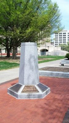
Location. 39° 2.863′ N, 95° 40.751′ W. Marker is in Topeka, Kansas, in Shawnee County. Marker is on the west grounds of the state Capitol, near SW Harrison Street and about 300 feet west of the SW entrance to the Capitol. Touch for map. Marker is at or near this postal address: 300 SW 10th Avenue, Topeka KS 66612, United States of America. Touch for directions.
Other nearby markers. At least 8 other markers are within walking distance of this marker. Kansas History (here, next to this marker); The Governor's Plaque (here, next to this marker); Kansas Children (here, next to this marker); The Kansa Tribe (here, next to this marker); Ad Astra Dedication Ceremony (here, next to this marker); Pioneer Women of Kansas (a few steps from this marker); Governor Landon's Acceptance (about 300 feet away, measured in a direct line); Charles Curtis (about 300 feet away). Touch for a list and map of all markers in Topeka.
Also see . . .
1. Kansas State Capitol. National Register of Historic Places nomination (Submitted on September 10, 2011, by William Fischer, Jr. of Scranton, Pennsylvania.)
2. Kansas State Capitol. Capitol building website (Submitted on September 10, 2011, by William Fischer, Jr. of Scranton, Pennsylvania.)
Credits. This page was last revised on January 8, 2021. It was originally submitted on September 10, 2011, by William Fischer, Jr. of Scranton, Pennsylvania. This page has been viewed 521 times since then and 15 times this year. Photos: 1, 2. submitted on September 10, 2011, by William Fischer, Jr. of Scranton, Pennsylvania. 3. submitted on September 10, 2011, by Mike Stroud of Bluffton, South Carolina.


