Governors Island in Manhattan in New York County, New York — The American Northeast (Mid-Atlantic)
Colonelsí Row
Governors Island
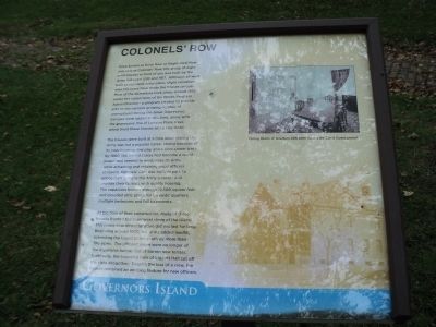
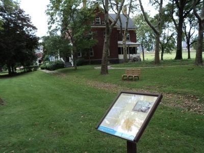
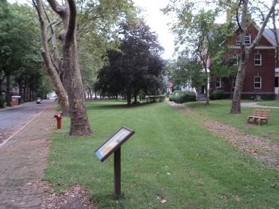
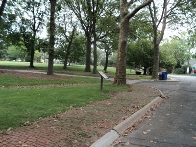
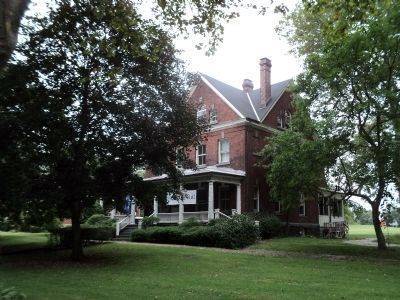
Once known as Brick Row or Regimental Row and now as Colonelsí Row, the group of eight brick houses in front of you was built by the Army between 1893 and 1917. Although all were built to standard Army plans, slight variations over the years have made the houses unique. Most of the alterations took place around 1938 under the supervision of the Works Progress Administration – a program created to provide jobs for the nationís growing number of unemployed during the Great Depression. Garages were added at this time, along with the impressive line of London Plane trees which front these houses along Hay Road.
The houses were built at a time when joining the Army was not a popular career choice because of its poor housing, low pay, and a slow career track. By 1900, the United States had become a world power and needed to modernize its Army while attracting and retaining good officers to lead it. Colonelsí Row was built, in part, to entice men to make the Army a career and provide their families with quality housing. The capacious houses average 12,500 square feet and included attic space for servantsí quarters, multiple bedrooms and full basements.
At the time of their construction, many of these houses fronted the southwest shore of the island. This prime beachfront location did not last for long. Beginning around 1900, the Army added landfill, extending the Island to the south by more than 100 acres. The officersí views were no longer of the expansive harbor, but of barren new terrain. Eventually, the imposing bulk of Liggett Hall cut off the vista altogether. Despite the loss of a view, the houses remained an enticing feature for new officers.
Topics and series. This historical marker is listed in this topic list: Military. In addition, it is included in the Works Progress Administration (WPA) projects series list. A significant historical year for this entry is 1893.
Location. 40° 41.321′ N, 74° 1.023′ W. Marker is in Manhattan, New York, in New York County. It is on Governors Island. Marker is at the intersection of Clayton Road and King Avenue, on the left when traveling east on Clayton Road. Marker is located on Governors Island. Touch for map. Marker is in this post office area: New York NY 10004, United States of America. Touch for directions.
Other nearby markers. At least 8 other markers are within walking distance of this marker. Comfort Road (within shouting distance of this marker); Reagan-Gorbachev Meeting 1988 (within shouting distance of this marker); The Fort Jay Theater (about 400 feet away, measured in a direct line); Clayton Road (about 400 feet away); Division Road (about 400 feet away); Polo on Governors Island (about 400 feet away); John Peter Zenger (about 500 feet away); Maj. General Hanson E. Ely Retirement (about 500 feet away). Touch for a list and map of all markers in Manhattan.
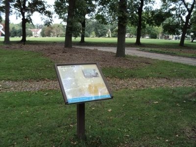
More about this marker. The background of the marker features a picture of one of the brick houses on Colonelsí Row. The upper right of the marker contains a photograph of the “Dining Room of Quarters 406 seen during the Coast Guard period.”
Also see . . . Governors Island National Monument. National Park Service website. (Submitted on September 12, 2011, by Bill Coughlin of Woodland Park, New Jersey.)
Credits. This page was last revised on January 31, 2023. It was originally submitted on September 12, 2011, by Bill Coughlin of Woodland Park, New Jersey. This page has been viewed 1,249 times since then and 175 times this year. Photos: 1, 2, 3, 4, 5, 6. submitted on September 12, 2011, by Bill Coughlin of Woodland Park, New Jersey.
