Governors Island in Manhattan in New York County, New York — The American Northeast (Mid-Atlantic)
The Governorís House
Governors Island
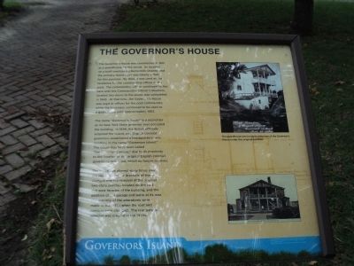
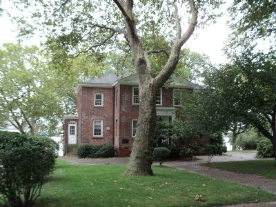
The Governorís House was constructed in 1813 as a guardhouse for the Island. Its location on a bluff overlooking Buttermilk Channel and the primary Island dock was ideally suited for this purpose. By 1824, it was used as the residence for the commanding officer of the post. The commanding officer continued to live here until the Commanding Officerís Quarters, located two doors to the south, was completed in 1843. At that time, the Governorís House was used as offices for the post commander, while the basement continued to be used as a guardhouse until approximately 1863.
The name “Governorís House” is a misnomer as no New York State governor ever occupied the building. In 1698, the British officially acquired the Island and English colonial governors established a headquarters here, resulting in the name “Governors Island.” The house may have been called “the Governorís House” due to its proximity to the location of the original English colonial governorís residence, which no longer survives.
The house was altered many times over the years. The most dramatic of these changes was the removal of the original two-story porches located on the east and west facades of the building, and the addition of the garage and patio at its rear. The majority of the alterations were made in the 1830s when the roof and porches were changed. The rear garage addition was created in the 1930s.
Topics. This historical marker is listed in these topic lists: Military • Notable Buildings. A significant historical year for this entry is 1813.
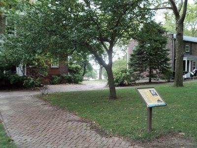
Location. 40° 41.452′ N, 74° 0.799′ W. Marker is in Manhattan, New York, in New York County. It is on Governors Island. Marker can be reached from Barry Road, on the left when traveling north. Marker is located in the Historic District of Governors Island. Touch for map. Marker is in this post office area: New York NY 10004, United States of America. Touch for directions.
Other nearby markers. At least 8 other markers are within walking distance of this marker. A different marker also named The Governors House (a few steps from this marker); a different marker also named The Governorís House (a few steps from this marker); The Dutch and Governors Island (a few steps from this marker); Nolan Park Stabilization (within shouting distance of this marker); Barry Road (within shouting distance of this marker); Commanding Officerís Quarters (within shouting distance of this marker); Pershing Hall (within shouting distance of this marker); The Pershing Oak (about 300 feet away, measured in a direct line). Touch for a list and map of all markers in Manhattan.
More about this marker. The background of the marker features an outline of the Governorís House. Two photographs also appear on the right side of the marker. One is an1864 picture of the house with a caption of “The guardhouse was located at the rear of the Governorís House under the original porches.” Below this is a postcard depicting “Post Headquarters, Fort Jay, NY.”
Also see . . .
1. History of Governors Island. The Trust for Governors Island website. (Submitted on September 13, 2011, by Bill Coughlin of Woodland Park, New Jersey.)
2. Governors Island National Monument. National Park Service website. (Submitted on September 13, 2011, by Bill Coughlin of Woodland Park, New Jersey.)
Credits. This page was last revised on February 17, 2024. It was originally submitted on September 13, 2011, by Bill Coughlin of Woodland Park, New Jersey. This page has been viewed 412 times since then and 25 times this year. Photos: 1, 2, 3, 4. submitted on September 13, 2011, by Bill Coughlin of Woodland Park, New Jersey.


