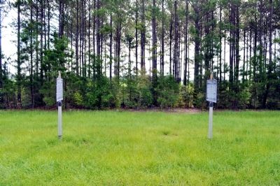
Oketeyeconne / Chattahoochee Theater
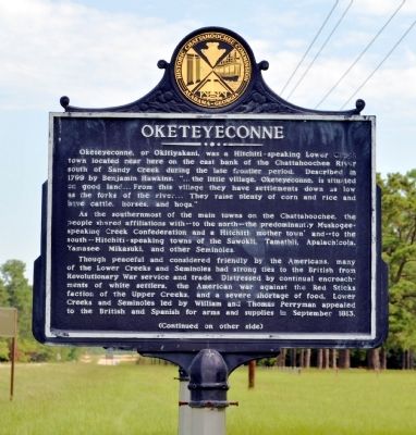
Oketeyeconne
Oketeyeconne, or Okitiyakani, was a Hitchiti-speaking Lower Creek town located near here on the east bank of the Chattahoochee River south of Sandy Creek during the late frontier period. Described in 1799 by Benjamin Hawkins, “. . . the little village, Oketeyeconne, is situated on good land . . . From this village they have settlements down as low as the forks of the river . . . They raise plenty of corn and rice and have cattle, horses, and hogs.”
As the southernmost of the main towns on the Chattahoochee, the people shared affiliations with -- to the north -- the predominantly Muskogee-speaking Creek Confederation and a Hitchiti ´mother town’ and -- to the south -- Hitchiti-speaking towns of the Sawokli, Tamathli, Apalachicola, Yamasee Mikasuki, and other Seminoles.
Though peaceful and considered friendly by the Americans, many of the Lower Creeks and Seminoles had strong ties to the British from Revolutionary War service and trade. Distressed by continual encroachments of white settlers, the American war against the Red Sticks faction of the Upper Creeks, and a severe shortage of food, Lower Creeks and Seminoles led by William and Thomas Perryman appealed to the British and Spanish for arms and supplies in September 1813.
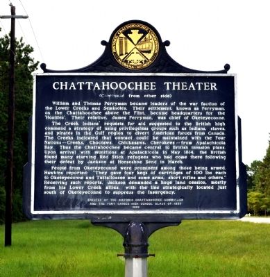
Chattahoochee Theater
William
The Creek Indians’ request for aid suggested to the British high command a strategy of using privilegeless groups such as Indians, slaves, and pirates in the Gulf region to divert American forces from Canada. The Creeks indicated that contact could be maintained with the Four Nations -- Creeks, Choctaws, Chickasaws, Cherokees -- from Apalachicola Bay. Thus the Chattahoochee became central to British invasion plans. Upon arrival with munitions at Apalachicola in May 1814, the British found many starving Red Stick refugees who had come there following their defeat by Jackson at Horseshoe Bend in March.
People from Oketeyeconne were prominent among those being armed. Hawkins reported: “They gave four kegs of cartridges of 100 lbs each to Oketeyeconne and Tuttallossee and some arms, short rifles and others.” Receiving such reports, Jackson demanded a huge land cession, mostly from his Lower Creek allies, with the line strategically located just south of Oketeyeconne to suppress the insurgency.
Erected 1989 by Historic Chattahoochee Commission and the Fort
Topics. This historical marker is listed in these topic lists: Native Americans • War of 1812 • Wars, US Indian. A significant historical month for this entry is May 1814.
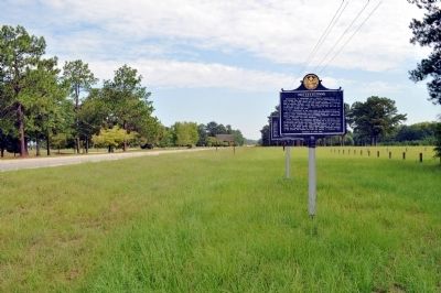
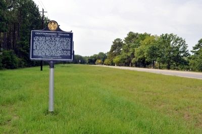
Location. 31° 38.017′ N, 85° 2.643′ W. Marker is in Fort Gaines, Georgia, in Clay County. Marker is on Eufaula Street (Georgia Route 39) 0.6 miles north of Coleman Road (Georgia Route 266), on the right when traveling north. The marker is located at the East Bank Recreation Area, Lake Walter F. George, just north of the road leading to the dam. Touch for map. Marker is in this post office area: Fort Gaines GA 39851, United States of America. Touch for directions.
Other nearby markers. At least 8 other markers are within 2 miles of this marker, measured as the crow flies. 1814 Boundary / Founding of Fort Gaines (here, next to this marker); Site of the First Clay County Courthouse and Jail (approx. 1.9 miles away); Historic Sites (approx. 1.9 miles away); Fort Gaines Guards (approx. 2 miles away); Old Pioneer Cemetery (approx. 2 miles away); The Old Lattice Bridge (approx. 2 miles away); In the Confederacy (approx. 2 miles away); The 1836 Fort (approx. 2 miles away). Touch for a list and map of all markers in Fort Gaines.
Credits. This page was last revised on June 16, 2016. It was originally submitted on September 16, 2011, by David Seibert of Sandy Springs, Georgia. This page has been viewed 3,391 times since then and 68 times this year. Photos: 1, 2, 3, 4, 5. submitted on September 16, 2011, by David Seibert of Sandy Springs, Georgia. • Bill Pfingsten was the editor who published this page.
