Topeka in Shawnee County, Kansas — The American Midwest (Upper Plains)
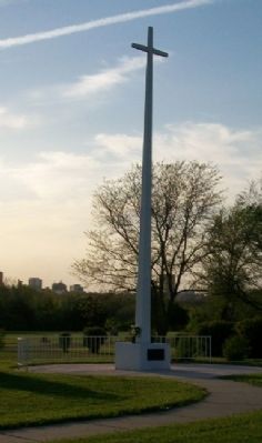
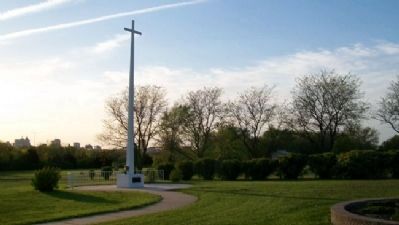
Topeka Tornado Victims
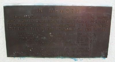
In Memory
tribute for those who worked
unselfishly in restoring our
city to normalcy, and as
a memorial to those who
lost their lives in the
tornado of June 8, 1966.
Lisle Grauer • Mary Beasley
Craig Beymer • Calvin Wolfe
John Wells • John Scheibe
W. R. Crouch • Gereford Lee
John D. Culver • Sterling Taylor
Edward J. Lyons • Hattie Anderson
Mrs. Calvin Wolfe • George A. Sklenicka
Oliver J. Milton • Mrs. Bertha Whitney
Donated to the citizens of this city
by Mr. and Mrs. Dana L. Hummer in memory
of their daughter Nancy 1947-1966
Erected by Mr. and Mrs. Dana L. Hummer.
Topics. This historical marker is listed in these topic lists: Cemeteries & Burial Sites • Disasters. A significant historical date for this entry is June 8, 1960.
Location. 39° 2.244′ N, 95° 39.151′ W. Marker is in Topeka, Kansas, in Shawnee County. Marker is in Section 96 of Topeka Cemetery. Touch for map. Marker is at or near this postal address: 1601 SE 10th Avenue, Topeka KS 66607, United States of America. Touch for directions.
Other nearby markers. At least 8 other markers are within 2 miles of this marker, measured as the crow flies. Charles Curtis (about 500 feet away, measured in a direct line); Henry Murphy Walsh and Every A.E.F. "Runner" (approx. 0.2 miles away); Franklin Loomis Crane (approx. ¼ mile away); Battle of the Blue (approx. 0.3 miles away); Crawford - Capper Burial Site (approx. 0.4 miles away); A Turning Point for Equality (approx. 1.2 miles away); A "Separate But Equal" School? (approx. 1.2 miles away); Standing Up for Their Rights (approx. 1.3 miles away). Touch for a list and map of all markers in Topeka.
Also see . . .
1. Topeka Tornado 1966. Kansas Historical Society website entry (Submitted on February 7, 2022, by Larry Gertner of New York, New York.)
2. The 1966 Topeka Tornado. National Weather Service website entry (Submitted on February 7, 2022, by Larry Gertner of New York, New York.)
3. A Twist of Fate. 1966 Tornado in Topeka Capital-Journal (Submitted on September 18, 2011, by William Fischer, Jr. of Scranton, Pennsylvania.)
Credits. This page was last revised on February 7, 2022. It was originally submitted on September 18, 2011, by William Fischer, Jr. of Scranton, Pennsylvania. This page has been viewed 1,143 times since then and 37 times this year. Photos: 1, 2, 3. submitted on September 18, 2011, by William Fischer, Jr. of Scranton, Pennsylvania.


