Near Troy in Doniphan County, Kansas — The American Midwest (Upper Plains)
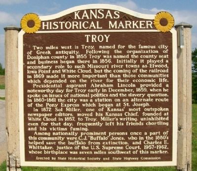
Troy
Two miles west is Troy, named for the famous city of Greek antiquity. Following the organization of Doniphan county in 1855 Troy was named the county seat and business began there in 1856. Initially it played a secondary role to such Missouri river towns as Elwood, Iowa Point and White Cloud, but the coming of the railroad in 1869 made it more important than those communities which depended on the river for their economic life.
Presidential aspirant Abraham Lincoln provided a noteworthy day for Troy early in December, 1859, when he spoke on issues of national politics and the slavery question. In 1860-1861 the city was a station on an alternate route of the Pony Express which began at St. Joseph.
In 1872 Sol Miller, one of Kansas' most outspoken newspaper editors, moved his Kansas Chief, founded at White Cloud in 1857, to Troy. Miller's writing, uninhibited even for that day, frequently left his friends chortling and his victims fuming.
Among nationally prominent persons once a part of this community were C.J."Buffalo" Jones, who in the 1880s helped save the buffalo from extinction, and Charles E. Whittaker, justice of the U.S. Supreme Court, 1957-1962, whose birthplace was seven miles southwest of this marker.
Erected by State Historical Society and State Highway Commission. (Marker Number 86.)
Topics and series. This historical marker is listed in these topic lists: Communications • Government & Politics • Settlements & Settlers. In addition, it is included in the Kansas Historical Society series list. A significant historical month for this entry is December 1859.
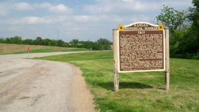
Location. 39° 47.59′ N, 95° 3.166′ W. Marker is near Troy, Kansas, in Doniphan County. Marker is on U.S. 36 near Ottumwa Road, on the left when traveling west. Marker is at the roadside rest area. Touch for map. Marker is in this post office area: Troy KS 66087, United States of America. Touch for directions.
Other nearby markers. At least 8 other markers are within 7 miles of this marker, measured as the crow flies. A different marker also named Troy (within shouting distance of this marker); Abraham Lincoln (approx. 2 miles away); Walter C. Worman and George Larson (approx. 2 miles away); "Tall Oak" (approx. 2 miles away); Doniphan County Courthouse (approx. 2 miles away); Melvin L. Schmidt, J.D. (approx. 2 miles away); Replica of the Statue of Liberty (approx. 2 miles away); "Espyd. a wolf" (approx. 6˝ miles away). Touch for a list and map of all markers in Troy.
Also see . . .
1. Doniphan County, Kansas. (Submitted on September 19, 2011, by William Fischer, Jr. of Scranton, Pennsylvania.)
2. Solomon Miller. (Submitted on September 19, 2011, by William Fischer, Jr. of Scranton, Pennsylvania.)
Credits. This page was last revised on December 9, 2021. It was originally submitted on September 19, 2011, by William Fischer, Jr. of Scranton, Pennsylvania. This page has been viewed 681 times since then and 34 times this year. Photos: 1, 2. submitted on September 19, 2011, by William Fischer, Jr. of Scranton, Pennsylvania.

