Flomaton in Escambia County, Alabama — The American South (East South Central)
Flomaton, Alabama
Front
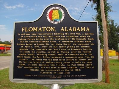
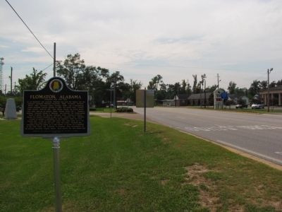
As railroads were reconstructed following the Civil War, a junction of north-south and east-west lines was established along the Alabama-Florida border near the confluence of Big Escambia Creek and the Conecuh-Escambia River. A settlement followed which became knows as Reuterville, for Major Reuter, the contractor who on April 9, 1872, drove the last spikes joining the different railroads. The community was also known as Pensacola Junction, or simply the Junction, as well as Whiting, after the railroad station master. Following several years of confusion due to the three names, the Post Office requested a permanent name from the citizens. The result was the first three letters of Florida and the last two letters of Alabama being joined to make the name Floma. To avoid confusion with Florala, the Post Office added "ton," meaning town, and the name became Flomaton. The Town of Flomaton was incorporated on May 18, 1908.
(Continued on other side)
Back
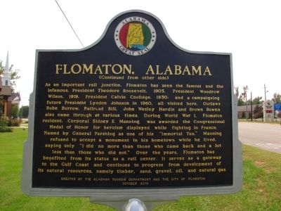
(Continued from other side)
As an important rail junction, Flomaton has seen the famous and the infamous. President Theodore Roosevelt, 1905, President Woodrow Wilson, 1919, President Calvin Coolidge, 1930, and a campaigning future President Lyndon Johnson in 1960, all visited here. Outlaws Rube Burrow, Railroad Bill, John Wesley Hardin and Brown Bowen also came through at various times. During World War I, Flomaton resident, Corporal Sidney E. Manning, was awarded the Congressional Medal of Honor for heroism displayed while fighting in France. Named by General Pershing as one of his "Immortal Ten," Manning refused to accept a monument in his hometown while he lived, saying only "I did no more than those who came back and a lot less than those who did not." Over the years, Flomaton has benefited from its status as a rail center. It serves as a gateway to the Gulf Coast and continues to progress from development of its natural resources, namely timber, sand, gravel, oil, and natural gas.
Erected 2010 by The Alabama Tourism Department and the City of Flomaton.
Topics and series. This historical marker is listed in these topic lists: Industry & Commerce • Patriots & Patriotism • Railroads & Streetcars • Settlements & Settlers. In addition, it is included in the Former U.S. Presidents: #26 Theodore Roosevelt, the Former U.S. Presidents: #28 Woodrow Wilson, the Former U.S. Presidents: #30 Calvin Coolidge, the Former U.S. Presidents: #36 Lyndon B. Johnson, and the Medal of Honor Recipients series lists. A significant historical month for this entry is April 1905.
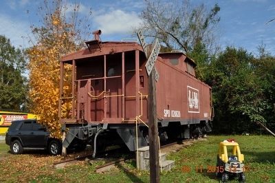
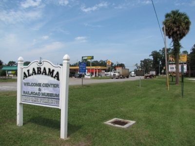
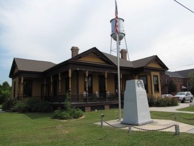
Location. 31° 0.236′ N, 87° 15.817′ W. Marker is in Flomaton, Alabama, in Escambia County. Marker is at the intersection of Sidney E Manning Blvd (U.S. 29) and Houston Street, on the right when traveling north on Sidney E Manning Blvd. Marker is located in front of the Alabama Welcome Center & Railroad Museum/Flomaton Chamber of Commerce Office. Touch for map. Marker is in this post office area: Flomaton AL 36441, United States of America. Touch for directions.
Other nearby markers. At least 8 other markers are within 6 miles of this marker, measured as the crow flies. Alabama's Own (within shouting distance of this marker); The Old Church Bell (about 300 feet away, measured in a direct line); Century, Florida / Alger Railroad (approx. 2.1 miles away in Florida); Francis B. Bonifay Law Office (approx. 5.6 miles away); The Lindsey-Fitzgerald House (approx. 5.6 miles away); Pollard Methodist Church (approx. 5.7 miles away); Pollard Station (approx. 5.7 miles away); Site of Pollard (approx. 6 miles away). Touch for a list and map of all markers in Flomaton.
Related markers. Click here for a list of markers that are related to this marker.
Credits. This page was last revised on September 29, 2020. It was originally submitted on September 23, 2011, by Lee Hattabaugh of Capshaw, Alabama. This page has been viewed 1,886 times since then and 74 times this year. Photos: 1, 2. submitted on September 23, 2011, by Lee Hattabaugh of Capshaw, Alabama. 3. submitted on November 30, 2015, by Sandra Hughes Tidwell of Killen, Alabama, USA. 4, 5, 6. submitted on September 23, 2011, by Lee Hattabaugh of Capshaw, Alabama. • Bill Pfingsten was the editor who published this page.
