Beatrice in Gage County, Nebraska — The American Midwest (Upper Plains)
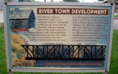
River Town Development
Many Heritage Highway communities began as river settlements. Beatrice was founded in 1857 near the bend of the Big Blue River. The first building, known as Pap Towle's cabin, was constructed just north of the present Gage County Historical Society Museum. This walnut log cabin served as a home, post office, courthouse and city hall for the new river town. The location of Premium Mills at Hebron in 1873 was an important event in the settlement of the town, as it was the "farthest west" mill in the southern part of the state, and farmers brought grist 200 miles. As you drive along Byway 136, you will visit many towns that were established near a river. Rivers provided water for the community residents as well as a means of transportation.
Erected by Heritage Highway U.S. Highway 136 Byway.
Topics. This historical marker is listed in these topic lists: Industry & Commerce • Roads & Vehicles • Settlements & Settlers • Waterways & Vessels. A significant historical year for this entry is 1857.
Location. 40° 15.964′ N, 96° 45.13′ W. Marker is in Beatrice, Nebraska, in Gage County. Marker is at the intersection of Court Street (U.S. 136) and 2nd Street, on the right when traveling west on Court Street. Touch for map. Marker is in this post office area: Beatrice NE 68310, United States of America. Touch for directions.
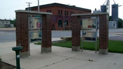
Other nearby markers. At least 8 other markers are within walking distance of this marker. The De Roin & Oregon Trails (here, next to this marker); Homesteading: The Cry was Free Land!!! (here, next to this marker); Railroads: Union Pacific & Burlington Northern (here, next to this marker); Founding of Beatrice, Nebraska Territory (within shouting distance of this marker); Replica of the Statue of Liberty (within shouting distance of this marker); Gage County Veterans Memorial (approx. half a mile away); Civil War and Spanish War Memorial (approx. half a mile away); Beatrice Veterans Memorial Wall of Honor (approx. 0.8 miles away). Touch for a list and map of all markers in Beatrice.
Also see . . .
1. Beatrice, Nebraska. Wikipedia entry (Submitted on September 26, 2011, by William Fischer, Jr. of Scranton, Pennsylvania.)
2. Heritage Highway Scenic Byway. Nebraska Tourism Commission website entry (Submitted on January 8, 2022, by Larry Gertner of New York, New York.)
Credits. This page was last revised on January 8, 2022. It was originally submitted on September 26, 2011, by William Fischer, Jr. of Scranton, Pennsylvania. This page has been viewed 520 times since then and 8 times this year. Photos: 1, 2. submitted on September 26, 2011, by William Fischer, Jr. of Scranton, Pennsylvania.

