Near Fort Mill in York County, South Carolina — The American South (South Atlantic)
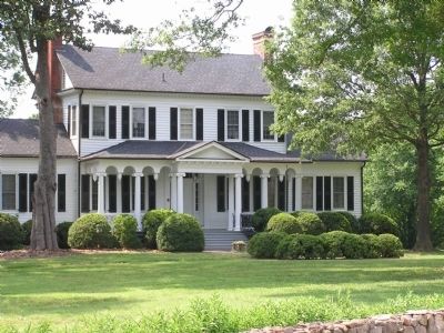
Springfield Plantation
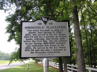
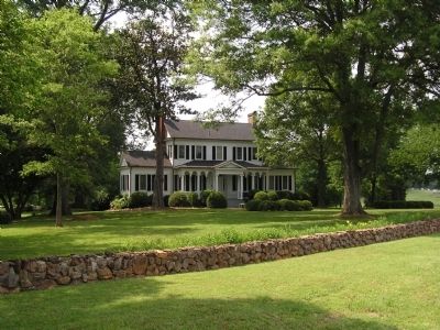
This house was built ca. 1806 for planter John Springs III (1782-1853), who served in the S.C. House 1828-34 and was a partner in several banks, railroads, and textile mills before the Civil War. His son Andrew Baxter Springs (1819-1886) enlarged and remodeled this house in the 1850s. He served in the S.C. House 1852-56 and was also a delegate to the Secession Convention.
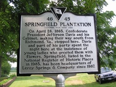
On April 26, 1865, Confederate President Jefferson Davis and his Cabinet, making their way south from Richmond, Va., stopped here. Davis and part of his party spent the night here at the insistence of young ladies who greeted them with flowers. Springfield, listed in the National Register of Historic Places in 1985, has been headquarters of Leroy Springs & Company since 1987.
Erected 2010 by Leroy Springs and Company, Inc. (Marker Number 46-45.)
Topics. This historical marker is listed in this topic list: War, US Civil. A significant historical month for this entry is April 1808.
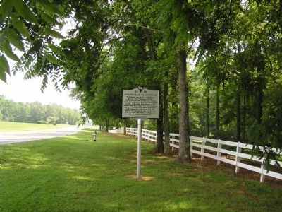
Location. 35° 2.879′ N, 80° 55.624′ W. Marker is near Fort Mill, South Carolina, in York County. Marker is on Old Nation Road (U.S. 21), on the right when traveling south. about 3 miles North of Fort Mill, SC. Touch for map. Marker is at or near this postal address: 2201 Old Nation Rd, Fort Mill SC 29715, United States of America. Touch for directions.
Other nearby markers. At least 8 other markers are within 3 miles of this marker, measured as the crow flies. George Fish School (approx. 2.6 miles away); a different marker also named George Fish School (approx. 2.6 miles away); World War II Memorial (approx. 2.7 miles away); World War I Memorial (approx. 2.7 miles away); In Honor of Those Who Have Served Our Country (approx. 2.7 miles away); Catawba Fort (approx. 2.9 miles away); Wilson House (approx. 2.9 miles away); Unity Presbyterian Church (approx. 2.9 miles away). Touch for a list and map of all markers in Fort Mill.
Also see . . . National Register of Historic Places Nomination Form. (Submitted on September 28, 2011, by Anna Inbody of Columbia, South Carolina.)
Credits. This page was last revised on June 22, 2021. It was originally submitted on September 28, 2011, by Anna Inbody of Columbia, South Carolina. This page has been viewed 1,667 times since then and 80 times this year. Photos: 1, 2, 3, 4, 5. submitted on September 28, 2011, by Anna Inbody of Columbia, South Carolina. • Craig Swain was the editor who published this page.
