Southport in Brunswick County, North Carolina — The American South (South Atlantic)
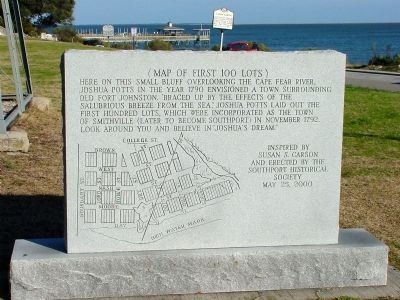
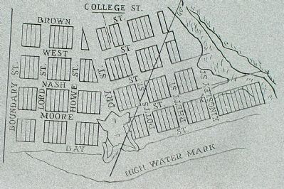
(Map of the First 100 Lots)
Erected 2000 by the Southport Historical Society. Inspired by Susan C. Carson.
Topics. This historical marker is listed in this topic list: Political Subdivisions. A significant historical month for this entry is November 1792.
Location. 33° 55.044′ N, 78° 1.062′ W. Marker is in Southport, North Carolina, in Brunswick County. Marker is at the intersection of South Davis Street and East Bay Street, on the right when traveling north on South Davis Street. Touch for map. Marker is in this post office area: Southport NC 28461, United States of America. Touch for directions.
Other nearby markers. At least 8 other markers are within walking distance of this marker. Mrs. Jessie Stevens Taylor (a few steps from this marker); Bald Head Lighthouse (within shouting distance of this marker); Fort Johnston (within shouting distance of this marker); Josiah Martin (within shouting distance of this marker); a different marker also named Fort Johnston (within shouting distance of this marker); a different marker also named Fort Johnston (within shouting distance of this marker); Catalino Tingzon (within shouting distance of this marker); Memorial to North Carolina Militia (about 300 feet away, measured in a direct line). Touch for a list and map of all markers in Southport.
Credits. This page was last revised on June 16, 2016. It was originally submitted on January 17, 2008, by J. J. Prats of Powell, Ohio. This page has been viewed 2,129 times since then and 63 times this year. Photos: 1, 2, 3. submitted on January 17, 2008, by J. J. Prats of Powell, Ohio.


