West Cambridge in Middlesex County, Massachusetts — The American Northeast (New England)
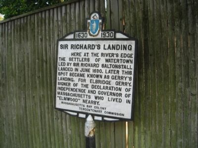
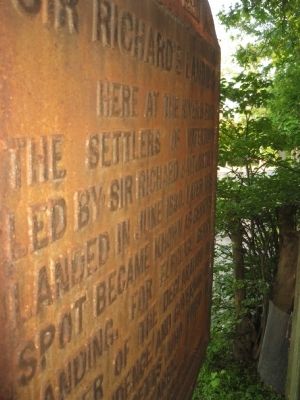
Sir Richard's Landing
1630 - 1930
Erected 1930 by Massachusetts Bay Colony-Tercentenary Commission.
Topics and series. This historical marker is listed in these topic lists: Colonial Era • Exploration • Government & Politics • Settlements & Settlers. In addition, it is included in the Massachusetts Bay Colony—Tercentenary Commission Markers series list. A significant historical month for this entry is June 1630.
Location. 42° 22.474′ N, 71° 8.277′ W. Marker is in Cambridge, Massachusetts, in Middlesex County. It is in West Cambridge. Marker is at the intersection of Mount Auburn Street and Fresh Pond Parkway (Massachusetts Route 2) on Mount Auburn Street. This marker is at the crossroads of Fresh Pond Parkway, Mount Auburn Street, Coolidge Hill Road and Elmwood Avenue. It is a very busy intersection and the marker is on the southern side of the intersection. Touch for map. Marker is at or near this postal address: 4102 Mt Auburn St, Cambridge MA 02138, United States of America. Touch for directions.
Other nearby markers. At least 8 other markers are within walking distance of this marker. Vassall-Craigie-Longfellow House (approx. 0.6 miles away); Emery T. Morris (approx. 0.6 miles away); The Shick House & Farm (approx. ¾ mile away); Harriet A. Jacobs (approx. ¾ mile away); Near this spot… (approx. 0.8 miles away); Gen. Henry Knox Trail (approx. 0.8 miles away); Old Charlestown – Watertown Path (approx. 0.8 miles away); Washington Elm (approx. 0.9 miles away). Touch for a list and map of all markers in Cambridge.
Regarding Sir Richard's Landing. This area of Cambridge was once Watertown until it was annexed. The boundary between Watertown and Cambridge was on present-day Sparks Street and that area westward including most of Brattle Street and Fresh Pond was part of Watertown. This marker shows that the town was founded in what is now Cambridge.
Also see . . .
1. Historical Markers Erected by Massachusetts Bay Colony Tercentenary Commission (1930). Original 1930 publication by the Commonwealth of Massachusetts of Tercentenary Commission Markers, commemorating the three hundredth anniversary of the Massachusetts Bay Colony. (Submitted on September 8, 2011, by Russell Chaffee Bixby of Bernardston, Massachusetts.)
2. Cambridge Historical Society. The Cambridge Historical Society has been a repository of history and culture for over 100 years. We are an active non-profit organization and are dedicated to promoting an interest in all aspects of the history and heritage of Cambridge. (Submitted on September 8, 2011, by Russell Chaffee Bixby of Bernardston, Massachusetts.)
Credits. This page was last revised on February 2, 2023. It was originally submitted on May 31, 2011, by David Russo of Watertown, Mass.. This page has been viewed 2,110 times since then and 43 times this year. Last updated on October 9, 2011, by Michael Tiernan of Danvers, Massachusetts. Photos: 1, 2. submitted on May 31, 2011, by David Russo of Watertown, Mass.. 3, 4. submitted on June 12, 2021, by Allen C. Browne of Silver Spring, Maryland. • Bill Pfingsten was the editor who published this page.


