Worcester in Worcester County, Massachusetts — The American Northeast (New England)
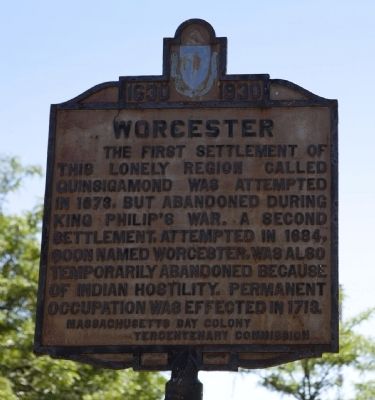
Worcester
1630 - 1930
The first settlement of this lonely region called Quinsigamond was attempted in 1673, but abandoned during King Philip's War. A second settlement, attempted in 1684, soon named Worcester, was also temporarily abandoned because of Indian hostility. Permanent occupation was effected in 1713.
Erected 1930 by Massachusetts Bay Colony-Tercentenary Commission.
Topics and series. This historical marker is listed in this topic list: Colonial Era. In addition, it is included in the Massachusetts Bay Colony—Tercentenary Commission Markers series list. A significant historical year for this entry is 1673.
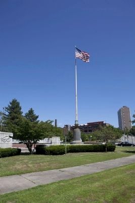
Location. 42° 16.296′ N, 71° 47.953′ W. Marker is in Worcester, Massachusetts, in Worcester County. Marker is at the intersection of Belmont Street (Massachusetts Route 9) and Grove Street, on the left when traveling west on Belmont Street. Marker stands in front of World War One memorial at Lincoln Square. Touch for map. Marker is at or near this postal address: 17 Lincoln Square, Worcester MA 01605, United States of America. Touch for directions.
Other nearby markers. At least 8 other markers are within walking distance of this marker. George Washington (within shouting distance of this marker); The First School-House in Worcester (within shouting distance of this marker); Gen. Henry Knox Trail (about 300 feet away, measured in a direct line); First Mill (about 600 feet away); Worcester's First City Hall (approx. 0.6 miles away); The Irish Community in Worcester (approx. 0.6 miles away); George Frisbie Hoar (approx. 0.6 miles away); War in Europe (approx. 0.6 miles away). Touch for a list and map of all markers in Worcester.
Also see . . . Historical Markers Erected by Massachusetts Bay Colony Tercentenary Commission (1930). Internet Archive website entry:
Original 1930 publication by the Commonwealth of Massachusetts of Tercentenary Commission Markers, commemorating the three hundredth anniversary of the Massachusetts Bay Colony. (Submitted on July 31, 2011, by Russell Chaffee Bixby of Bernardston, Massachusetts.)
Credits. This page was last revised on March 25, 2022. It was originally submitted on July 31, 2011, by Russell Chaffee Bixby of Bernardston, Massachusetts. This page has been viewed 901 times since then and 21 times this year. Last updated on October 9, 2011, by Michael Tiernan of Danvers, Massachusetts. Photos: 1, 2. submitted on July 31, 2011, by Russell Chaffee Bixby of Bernardston, Massachusetts. • Bill Pfingsten was the editor who published this page.

