Fort Trumbull in New London in New London County, Connecticut — The American Northeast (New England)
Fort Trumbull
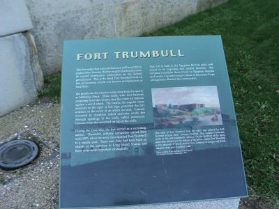
This five-sided fort was built between 1839 and 1852 to protect New London Harbor as part of a broad system of coastal fortification undertaken by the federal government. This is the third Fort Trumbull built on this promontory, which was known as Mamacock or Fort Neck.
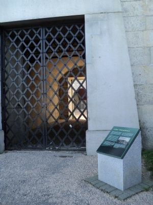
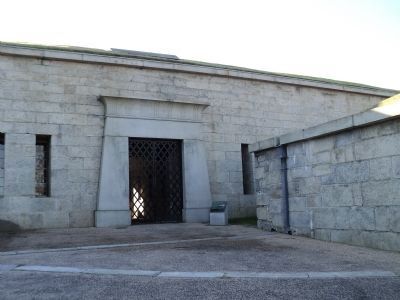
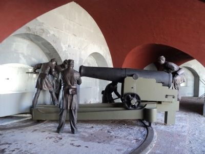
The granite for the massive walls came from the quarry at Millstone Point. Three walls, with four bastions projecting for the corners, face the water for defense against a naval attack. The ravelin, the angular stone structure to the right of this sign, protected the fort entrance in the event of an attack on land. Cannon mounted in chambers called casemates could fire through openings in the walls, called embrasures. Cannon were also mounted on top of the walls.
During the Civil War, the fort served as a recruiting station. Thereafter, artillery companies served here until 1907, when the army downgraded Fort Trumbull to a supply post. Three new forts had been built on islands at the entrance to Long Island Sound, and these were more important strategically.
This fort is built in the Egyptian Revival style, well suited to its imposing and somber function. The entrance resembles those found on Egyptian temples and tombs. Captain George Cullum of the Army Corps of Engineers directed the construction.
Erected by Fort Trumbull State Park.
Topics. This historical marker is listed in these topic lists: Forts and Castles • War, US Civil. A significant historical year for this entry is 1839.
Location. 41° 20.636′ N, 72° 5.61′ W. Marker is in New London, Connecticut, in New London County. It is in Fort Trumbull. Marker can be reached from East Street, on the left when traveling south. Marker is located in Fort Trumbull State Park. Touch for map. Marker is in this post office area: New London CT 06320, United States of America. Touch for directions.
Other nearby markers. At least 8 other markers are within walking distance of this marker. Bottom Reflected Active Sonar System (BRASS) (a few steps from this marker); Cold War (within shouting distance of this marker); Scientific Research (within shouting distance of this marker); Merchant Marine (within shouting distance of this marker); North Battery (within shouting distance of this marker); a different marker also named Scientific Research (within shouting distance of this marker); Parade Ground (within shouting distance of this marker); “Aim, Load, Fire” (within shouting distance of this marker). Touch for a list and map of all markers in New London.
More about this marker. A picture of Fort Trumbull at the lower right of the marker has a caption of “This view of Fort Trumbull from the water was painted by Seth Eastman around 1870. Frances Caulkins, New London’s historian, wrote in the mid-nineteenth century, ‘In the forefront of the town, admirably situated for the defense of the harbor, stands Fort Trumbull, a fine specimen of mural architecture, complete in design and finish, massive, new, and in perfect order.’
Photo courtesy of the Architect of the Capital, U.S. Senate Collection, Washington, D.C.”
Also see . . . History of Fort Trumbull. Friends of Fort Trumbull website. (Submitted on October 13, 2011, by Bill Coughlin of Woodland Park, New Jersey.)
Credits. This page was last revised on February 10, 2023. It was originally submitted on October 13, 2011, by Bill Coughlin of Woodland Park, New Jersey. This page has been viewed 714 times since then and 20 times this year. Photos: 1, 2, 3, 4, 5. submitted on October 13, 2011, by Bill Coughlin of Woodland Park, New Jersey.
